

Form 6-K AGRIUM INC For: Nov 13
 Tweet
Tweet Share
Share�
�
SECURITIES AND EXCHANGE COMMISSION
Washington, D.C. 20549
�
�
Form 6-K
�
�
Report of Foreign Issuer
Pursuant to Section�13a-16 or 15d-16 of the
Securities Exchange Act of 1934
For the month of: November, 2014
Commission File Number: 001-14460
�
�
AGRIUM INC.
(Name of registrant)
�
�
13131 Lake Fraser Drive S.E.,
Calgary, Alberta,
Canada T2J 7E8
(Address of principal executive offices)
�
�
Indicate by check mark whether the registrant files or will file annual reports under cover of Form 20-F or Form 40-F:
Form 20-F���������������Form 40-F��x
Indicate by check mark if the registrant is submitting the Form 6-K in paper as permitted by Regulation S-T Rule 101(b)(1):���
Indicate by check mark if the registrant is submitting the Form 6-K in paper as permitted by Regulation S-T Rule 101(b)(7):���
The expert consents included as Exhibits 99.2, 99.3 and 99.4 of this Form 6-K are hereby incorporated by reference into and as an exhibit to the Registrant�s Registration Statement under the Securities Act of 1933, as amended, on Form F-10 (File No.�333-195266).
�
�
�
SIGNATURES
Pursuant to the requirements of the Securities Exchange Act of 1934, the registrant has duly caused this report to be signed on its behalf by the undersigned, thereunto duly authorized.
�
| � | � | AGRIUM INC. | ||||
| Date: November 13, 2014 | � | � | By: | � | /s/ Gary J. Daniel | |
| � | � | Name: | � | Gary J. Daniel | ||
| � | � | Title: | � | Corporate Secretary & Senior Legal Counsel | ||
EXHIBIT INDEX
�
| Exhibit |
�� | Description of Exhibit |
| 99.1 | �� | Technical Report, dated effective October 31, 2014. |
| 99.2 | �� | Consent of A. Dave Mackintosh, B.Sc., P. Geo, dated November 13, 2014. |
| 99.3 | �� | Consent of Dennis Grimm, P.Eng, dated November 13, 2014. |
| 99.4 | �� | Consent of Michael Ryan Bartsch, P.Eng, dated November 13, 2014. |
EXHIBIT 99.1
�
| �� | AGRIUM INC. � Vanscoy Potash Operations � National Instrument 43-101 � Technical Report on Vanscoy Potash Operations, Vanscoy, Saskatchewan, Canada � Effective Date October�31, 2014 � Michael Ryan Bartsch, P. Eng. Agrium�Vanscoy�Potash�Operations � Dennis Grimm, P.Eng. Agrium Vanscoy Potash Operations � And � A. Dave Mackintosh, P.Geo. ADM Consulting Limited |
�
AGRIUM
VANSCOY POTASH OPERATIONS
1
CERTIFICATE OF QUALIFIED PERSON
I, Dennis William Aldo Grimm, P. Eng., having an address at #16 Agrium Road, Vanscoy, Saskatchewan, Canada S0L 3J0, do hereby certify that:
I am Senior Supervisor, Metallurgy at Agrium�s Vanscoy Potash Operations site (the �VPO Site�), and am one of the coauthors of the report titled �National Instrument 43-101 Technical Report on Vanscoy Potash Operations, Vanscoy, Saskatchewan, Canada� with an effective date of October�31, 2014 (the �Technical Report�).
I graduated with a degree in mining and mineral processing engineering from the University of British Columbia in 2004. I am a member of the Association of Professional Engineers and Geoscientists of Saskatchewan. I have worked as a mineral processing engineer and in fertilizer manufacturing for a total of 10 years since my graduation from university.
I have read the definition of �qualified person� set out in National Instrument 43-101 (�NI 43-101�) and certify that by reason of my education, affiliation with a professional association (as defined in NI 43-101) and past relevant work experience, I fulfill the requirements to be a �qualified person� for the purposes of NI 43-101.
I am responsible for sections 1-3, 13, 17 and 24-27 of the Technical Report. As of the effective date, to the best of my knowledge, information, and belief, this Technical Report contains all scientific and technical information that is required to be disclosed in order to make this Technical Report not misleading.
I have worked on the VPO Site for 1.5 years between March 2013 through October 2014 in the area of mineral processing optimization. The date of my last visit to the VPO Site was October�31, 2014 for 10 hours.
I am not independent as described in section 1.5 of NI 43-101 of the issuer. I have read NI 43-101 and the Technical Report and certify that those sections of the Technical Report that I am responsible for have been prepared in compliance with NI�43-101.
Dated this 31st day of October 2014.
�
| �Dennis Grimm� � |
� | � | �Signed�and�Sealed� | |
| Signature of Qualified Person | � | � | ||
| Dennis Grimm, P.Eng. | � | � | ||
The original author signed and sealed documents are kept in office.
�
AGRIUM
VANSCOY POTASH OPERATIONS
2
CERTIFICATE OF QUALIFIED PERSON
I, Andrew David Mackintosh, P. Geo., with an address at Box 32, Vanscoy, Saskatchewan, Canada S0L�3J0 do hereby certify that:
I am President of ADM Consulting Limited and I am one of the coauthors of the report titled �National Instrument 43-101 Technical Report on Vanscoy Potash Operations, Vanscoy, Saskatchewan, Canada� with an effective date of October�31, 2014 (the �Technical Report�). I graduated with a degree in geology from the University of Saskatchewan in 1985.
I am a member of the Association of Professional Engineers and Geoscientists of Saskatchewan with permission to consult, the Canadian Institute of Mining, Metallurgy and Petroleum, the Canadian Rock Mechanics Association, and the International Society for Rock Mechanics. I have worked as a geologist for a total of 29 years since my graduation from university.
I have had prior involvement with the property that is the subject of the Technical Report having worked for Agrium Inc. (�Agrium�) both as an employee from 1969 to 1996, and as a consultant since 1996. In these capacities, I have visited all the conventional Saskatchewan potash mines on numerous occasions, none of which were related to this Technical Report. As I continue to review underground conditions, participate in mining studies, and mentor new geologists and engineers. My last site visit was for 8 hours on August�18, 2014.
I have read the definition of �qualified person� set out in National Instrument 43-101 (�NI 43-101�) and certify that by reason of my education, affiliation with a professional association (as defined in NI 43-101) and past relevant work experience, I fulfill the requirements to be a �qualified person� for the purposes of NI 43-101.
I am responsible for the preparation of sections 1-12, 14-15, 18 and 23-27 of the Technical Report. As of the effective date, to the best of my knowledge, information and belief, this Technical Report contains all scientific and technical information that is required to be disclosed in order to make this Technical Report not misleading.
I am independent of the issuer as the term �independence� is described in section 1.5 of NI 43-101. I have read NI 43-101 and the Technical Report and certify that those sections of the Technical Report that I am responsible for have been prepared in compliance with NI�43-101.
Dated this 31st day of October 2014.
�
| �A. Dave Mackintosh� � |
� | � | �Signed and Sealed� | |
| Signature of Qualified Person | � | � | ||
| A. Dave Mackintosh, P.Geo. | � | � | ||
The original author signed and sealed documents are kept in office.
�
AGRIUM
VANSCOY POTASH OPERATIONS
3
CERTIFICATE OF QUALIFIED PERSON
I, Michael Ryan Bartsch, P. Eng., having an address at #16 Agrium Road, Vanscoy, Saskatchewan, Canada S0L 3J0, do hereby certify that:
I am Superintendent, Mine Engineering at Agrium�s Vanscoy Potash Operations site (the �VPO Site�), and am one of the coauthors of the report titled �National Instrument 43-101 Technical Report on Vanscoy Potash Operations, Vanscoy, Saskatchewan, Canada� with an effective date of October�31, 2014 (the �Technical Report�).
I graduated with a degree in Geological Engineering from the University of Saskatchewan in 2002. I have worked as a mine engineer and Mine Superintendent for a total of 12 years since my graduation from university. I am a member of the Association of Professional Engineers and Geoscientists of Saskatchewan, Professional Engineers Ontario and the Canadian Institute of Mining, Metallurgy and Petroleum.
I have read the definition of �qualified person� set out in National Instrument 43-101 (�NI 43-101�) and certify that by reason of my education, affiliation with a professional association (as defined in NI 43-101) and past relevant work experience, I fulfill the requirements to be a �qualified person� for the purposes of NI 43-101. I am responsible for the preparation of sections 1-5, 12, 16, 19-27 of the Technical Report.
I have worked on the VPO Site from January 2013 through October�31, 2014 in the areas of mine planning, underground mine geology and underground rock mechanics. My last site visit was for 10 hours on October�31, 2014. Previously I worked at the Ojibway Mine in Windsor Ontario for 5 years as the Mine Superintendent and at PotashCorp.�s Allan Mine as a Mine Engineer for 6�years. I worked in mine production, mine planning, mine geology, underground rock mechanics, capital projects, and underground supervision.
I am not independent of the issuer for the purposes of section 1.5 of NI 43-101. I have read NI 43-101 and the Technical Report, and certify that those sections of the Technical Report that I am responsible for have been prepared in compliance with NI�43-101.
Dated this 31st day of October 2014.
�
| �Michael Bartsch� � |
� | � | �Signed and Sealed� | |
| Signature of Qualified Person | � | � | ||
| Michael R. Bartsch, P.Eng. | � | � | ||
The original author signed and sealed documents are kept in office.
�
AGRIUM
VANSCOY POTASH OPERATIONS
4
Table of Contents
�
| TABLE OF CONTENTS |
�� | � | 5 | �� | ||||
| LIST OF TABLES |
�� | � | 6 | �� | ||||
| LIST OF FIGURES |
�� | � | 7 | �� | ||||
| 1 |
� | SUMMARY |
�� | � | 8 | �� | ||
| � | 1.1 |
� | INTRODUCTION | �� | � | 8 | �� | |
| � | 1.2 |
� | KEY OUTCOMES | �� | � | 12 | �� | |
| � | 1.3 |
� | CAUTIONARY NOTES | �� | � | 14 | �� | |
| 2 |
� | INTRODUCTION | �� | � | 17 | �� | ||
| 3 |
� | RELIANCE ON OTHER EXPERTS | �� | � | 20 | �� | ||
| 4 |
� | PROPERTY DESCRIPTION AND LOCATION | �� | � | 21 | �� | ||
| 5 |
� | ACCESSIBILITY, CLIMATE, LOCAL RESOURCES, INFRASTRUCTURE AND PHYSIOGRAPHY | �� | � | 28 | �� | ||
| 6 |
� | HISTORY | �� | � | 29 | �� | ||
| 7 |
� | GEOLOGICAL SETTING AND MINERALIZATION | �� | � | 31 | �� | ||
| 8 |
� | DEPOSIT TYPES | �� | � | 35 | �� | ||
| 9 |
� | EXPLORATION | �� | � | 36 | �� | ||
| 10 |
� | DRILLING | �� | � | 38 | �� | ||
| 11 |
� | SAMPLE PREPARATION, ANALYSES AND SECURITY | �� | � | 45 | �� | ||
| 12 |
� | DATA VERIFICATION | �� | � | 52 | �� | ||
| 13 |
� | MINERAL PROCESSING AND METALLURGICAL TESTING | �� | � | 54 | �� | ||
| 14 |
� | MINERAL RESOURCE ESTIMATES | �� | � | 58 | �� | ||
| � | 14.1 |
� | KEY PARAMETERS | �� | � | 58 | �� | |
| � | 14.2 |
� | BLOCK MODEL GRADE ESTIMATION | �� | � | 60 | �� | |
| 15 |
� | MINERAL RESERVE ESTIMATES | �� | � | 64 | �� | ||
| � | 15.1 |
� | KEY ASSUMPTIONS AND PARAMETERS | �� | � | 64 | �� | |
| 16 |
� | MINING METHODS | �� | � | 67 | �� | ||
| 17 |
� | RECOVERY METHODS | �� | � | 69 | �� | ||
| 18 |
� | PROJECT INFRASTRUCTURE | �� | � | 75 | �� | ||
| 19 |
� | MARKET STUDIES AND CONTRACTS | �� | � | 77 | �� | ||
| 20 |
� | ENVIRONMENTAL STUDIES, PERMITTING AND SOCIAL OR COMMUNITY IMPACT | �� | � | 82 | �� | ||
| 21 |
� | CAPITAL AND OPERATING COSTS | �� | � | 84 | �� | ||
| 22 |
� | ECONOMIC ANALYSIS | �� | � | 86 | �� | ||
| 23 |
� | ADJACENT PROPERTIES | �� | � | 88 | �� | ||
| 24 |
� | OTHER RELEVANT DATA AND INFORMATION | �� | � | 89 | �� | ||
| 25 |
� | INTERPRETATION AND CONCLUSIONS | �� | � | 90 | �� | ||
| 26 |
� | RECOMMENDATIONS | �� | � | 92 | �� | ||
| 27 |
� | REFERENCES | �� | � | 93 | �� | ||
�
AGRIUM
VANSCOY POTASH OPERATIONS
5
List of Tables
�
| TABLE 1-1: MUNICIPAL & NTS BLOCK LOCATIONS | �� | � | 9 | �� |
| TABLE 1-2: MINERAL RESOURCES SUMMARY | �� | � | 13 | �� |
| TABLE 1-3: MINERAL RESERVES SUMMARY | �� | � | 13 | �� |
| TABLE 2-1: DEFINITIONS�& COMMON TERMS | �� | � | 19 | �� |
| TABLE 4-1: MUNICIPAL, NTS BLOCK LOCATIONS�& MINESITE LEGAL LAND LOCATION | �� | � | 21 | �� |
| TABLE 4-2: AREA OF VPO LEASE SUBDIVISIONS�& MINERAL RIGHTS | �� | � | 25 | �� |
| TABLE 10-1: DRILL HOLE COMPOSITES | �� | � | 43 | �� |
| TABLE 10-2: CHANNEL SAMPLE COMPOSITES | �� | � | 44 | �� |
| TABLE 13-1: ANNUAL PRODUCTION FOR VPO MILL | �� | � | 55 | �� |
| TABLE 13-2: AVERAGE POTASH RECOVERY FOR VPO MILL | �� | � | 56 | �� |
| TABLE 14-1: BLOCK MODEL PARAMETERS USED | �� | � | 61 | �� |
| TABLE 14-2: ESTIMATION SAMPLE SELECTION BASED ON DATA DENSITY | �� | � | 61 | �� |
| TABLE 14-3: AGRIUM VPO MINERAL RESOURCE SUMMARY AS OF AUGUST�8, 2014 | �� | � | 63 | �� |
| TABLE 15-1: AGRIUM VPO MINERAL RESERVE SUMMARY AS OF AUGUST�31, 2014 | �� | � | 65 | �� |
| TABLE 21-1: FORECASTED VAULT EXPANSION CAPITAL COSTS | �� | � | 85 | �� |
| TABLE 22-1: SENSITIVITY ANALYSIS RESULTS ON VAULT EXPANSION PROJECT | �� | � | 87 | �� |
�
AGRIUM
VANSCOY POTASH OPERATIONS
6
List of Figures
�
| FIGURE 1-1: LOCATION OF VPO & OTHER CONVENTIONAL SASKATCHEWAN POTASH MINES | �� | � | 10 | �� |
| FIGURE 4-1: LOCATION MAP | �� | � | 22 | �� |
| FIGURE 4-2: ADJACENT DISPOSITIONS | �� | � | 23 | �� |
| FIGURE 4-3: MINE WORKINGS, LEASE BOUNDARY�& AREAS | �� | � | 24 | �� |
| FIGURE 4-4: FREEHOLD SUBSURFACE MINERAL RIGHTS | �� | � | 26 | �� |
| FIGURE 4-5: SURFACE OWNERSHIP | �� | � | 27 | �� |
| FIGURE 7-1: IDEALIZED STRATIGRAPHIC COLUMN | �� | � | 33 | �� |
| FIGURE 7-2: LOCAL STRATIGRAPHY IN RELATION TO MINING LEVEL | �� | � | 34 | �� |
| FIGURE 9-1: 3D AND 2D SEISMIC COVERAGE | �� | � | 37 | �� |
| FIGURE 10-1: DRILL HOLE LOCATIONS | �� | � | 39 | �� |
| FIGURE 11-1: COMPARISON OF 2000 MINE SITE LAB ASSAYS�& 2009 SRC ASSAYS | �� | � | 47 | �� |
| FIGURE 11-2: REMOVING SAMPLE BLOCKS FROM THE MINE WALL | �� | � | 49 | �� |
| FIGURE 11-3: SECTION OF MINE WALL WITH SAMPLES REMOVED | �� | � | 50 | �� |
| FIGURE 11-4: COMPLETED CHANNEL SAMPLE LOCATION | �� | � | 51 | �� |
| FIGURE 14-1: BLOCK MODEL GRADE ESTIMATION RESULTS AND COMPOSITES USED | �� | � | 62 | �� |
| FIGURE 15-1: MINERAL RESOURCES AND RESERVE CLASSIFICATION MAP | �� | � | 66 | �� |
| FIGURE 16-1: BORER MINER | �� | � | 67 | �� |
| FIGURE 19-1: GLOBAL POTASH SUPPLY | �� | � | 77 | �� |
| FIGURE 19-2: GLOBAL POTASH PRODUCTION | �� | � | 78 | �� |
| FIGURE 19-3: GLOBAL POTASH EXPORTS | �� | � | 79 | �� |
| FIGURE 19-4: HISTORIC VANCOUVER FOB POTASH PRICES | �� | � | 80 | �� |
�
AGRIUM
VANSCOY POTASH OPERATIONS
7
| 1 | SUMMARY |
�
| 1.1 | INTRODUCTION |
Through AGRIUM, a general partnership comprised of Agrium Inc., Agrium Products Inc. and Viridian Fertilizers Limited, all being wholly-owned subsidiaries of Agrium Inc., Agrium owns and operates Vanscoy Potash Operations (�VPO�), a potash mining and milling facility located in Vanscoy, Saskatchewan (southwest of Saskatoon, Figure 1-1). The operation has been in existence for over 45 years and has produced over 49�million tonnes of muriate of potash.
In this technical report, unless the context otherwise indicates, �Agrium� refers to Agrium Inc., its subsidiaries and any partnership of which Agrium and its subsidiaries are partners. Agrium is a major retailer of agricultural products and services in North and South America, a leading global wholesale producer and marketer of agricultural nutrients and the premier supplier of specialty fertilizers in North America. Agrium produces and markets all three primary groups of nutrients: nitrogen, phosphate and potash, as well as controlled-release fertilizers. Agrium�s strategy is to grow through incremental expansion of its existing operations, acquisitions, development, commercialization, and marketing of new products and international opportunities.
To that end, Agrium is currently in the process of completing a material expansion of VPO. The Vanscoy Ultimate Expansion (�VAULT�) will add 1.0 mtpy of product capacity. This expansion includes increased hoisting capacity, an increase to the underground mining fleet, a second parallel milling facility, additional compaction capacity and other enhancements to the site to support the increases.
The Saskatchewan Ministry of Energy and Resources (�SMER�) has granted Agrium the exclusive right to mine potash on approximately 148,652 acres of crown land pursuant to Subsurface Mineral Lease KL 114-A and KL 204, last revised August 2013, and herein designated the VPO Lease. The lands designated VPO Lease, that are the subject of this report, form a contiguous area in excess of 189,333 acres containing the lands subject to the Subsurface Mineral Leases KL 114-A and KL 204, lands owned by Agrium, and freehold mineral rights owned by others and leased by Agrium (the �VPO Lease Lands�). Freehold mineral rights not leased by Agrium are not included. These lands are located in the Province of Saskatchewan, Canada, in the rural municipalities and National Topographic System of Canada (NTS) blocks indicated in Table�1-1.
�
AGRIUM
VANSCOY POTASH OPERATIONS
8
Table 1-1: Municipal�& NTS Block Locations
�
| R.M. Name |
�� | R.M.�Number |
�� | NTS�Block |
| Corman Park | �� | 344 | �� | 073B03/02 |
| Vanscoy | �� | 345 | �� | 072O14/15 |
| Montrose | �� | 315 | �� | 072O14/15 |
The VPO Lease Lands are located within townships 33 to 37 of ranges 6 to 9, west of the 3rd meridian.
�
AGRIUM
VANSCOY POTASH OPERATIONS
9
�

Figure 1-1: Location of VPO�& Other Conventional Saskatchewan Potash Mines
(Source � Natural Resources of Canada website)
�
AGRIUM
VANSCOY POTASH OPERATIONS
10
Canadian potash deposits are estimated to be among the largest in the world and are mostly located in a band that stretches over 700 km (450 miles) across Saskatchewan. The deposits lie diagonally across the southern plains of Saskatchewan, gently sloping from approximately 1,000 m in depth along a northwest line through Rocanville, Esterhazy and Saskatoon to more than 1,600 m in depth at Belle Plaine and up to 3,000 m in depth in North Dakota. According to Holter (1969), the known deposits are massive, with �total recoverable reserves estimated at 107 billion tonnes�.
The Prairie Evaporite Formation forms part of the Elk Point Basin, a sub-basin of the Williston Basin centred on the northwest corner of North Dakota. The deposits are all sedimentary with the potash minerals representing the final stages of evaporation of a shallow inland sea. The depositional model described by Garrett as sequential flow during evaporation, suggests the Saskatchewan Sub-Basin, the Central Alberta Sub-Basin, and the Northern Alberta Sub-Basin were cut off from the seas by the Presqu�lle barrier reef. The potash salts are confined to the Saskatchewan Sub-Basin. There are three potash members occurring in the Prairie Evaporite: the Esterhazy Member (mined at Mosaic Esterhazy and Potash Corporation of Saskatchewan (�PCS�) Rocanville Division), the Patience Lake Member (mined in the Saskatoon area) and the Belle Plaine Member, which is not currently conventionally mined. The Esterhazy Member was the first potash bearing bed to be deposited and therefore is stratigraphically the deepest. However, the Rocanville/Esterhazy area mines are shallower than the younger Patience Lake Member mines in the Saskatoon area because of their proximity to the basin edge.
The property was initially developed by the Consolidated Mining and Smelting Company of Canada Limited (C.M.&S) of Trail, British Columbia, subsequently Cominco Ltd., based on a total of 23 drill holes completed in 1964. Since then, 17 additional drill holes and numerous seismic programs have been completed over the lands subject to the KL 114-A lease and the KL 204 Lands. Mineralization is a mixture of sylvite and halite, commonly referred to as sylvinite, with minor water insoluble clays. Data from all potash exploration wells drilled in the province is stored at the Saskatchewan Ministry of Energy and Resources (�SMER�) Subsurface Laboratory or in geodata offices in Regina.
Mining operations at the site started in 1969 in the Patience Lake Member, with site ownership eventually devolving to Cominco Fertilizers Inc. and finally to the separate entity, Agrium, in 1995. In the 45 years of mining history of the site, production has resulted in the total extraction of 145.6�million tonnes at an average grade of 24.7% K2O and 4.7% insolubles, yielding 49.3�million tonnes of muriate of potash.
Agrium commissioned ADM Consulting Limited (�ADM�) to assist VPO�s personnel in the review of mine data and preparation of a technical report in accordance with National Instrument 43-101 � Standards of Disclosure for Mineral Projects (�NI 43-101�) and Form 43-101F1 (the �2012 Report�). This updated technical report replaces the 2012 Report, incorporating subsequent seismic acquisition to update Mineral Resource and Mineral Reserve estimates, all in accordance with NI�43-101.
�
AGRIUM
VANSCOY POTASH OPERATIONS
11
| 1.2 | KEY OUTCOMES |
For reporting purposes, the VPO Lease Lands have been divided into three areas:
1) the Unitized Area containing most of the mining to date;
2) the South Block to the south and east of the shafts (currently under development);
3) the North Expansion Block north of the Unitized Area.
The criteria used to assign Mineral Reserves in previous Technical Reports, particularly for Proven Mineral Reserves, were very specific to mining methods used at VPO and reflect the internal reporting criterion for forecasting production. Criteria for reporting Proven and Probable Mineral Reserves have been chosen to align more with industry reporting practices, and to allow flexibility in investigating alternative mining methods.
The Mineral Resource and Mineral Reserve estimates for the VPO Lease are summarized in the following tables 1.1 and 1.2.
�
AGRIUM
VANSCOY POTASH OPERATIONS
12
Table 1-2: Mineral Resources Summary
�
| Area |
�� | Mineral Resources | ||||
| South Block |
�� | Millions�of |
�� | Grade�%K2O |
�� | %�Insolubles |
| Measured | �� | 687.0 | �� | 23.4 | �� | 5.0 |
| Indicated | �� | 214.9 | �� | 25.4 | �� | 5.2 |
| Inferred | �� | 962.1 | �� | 24.9 | �� | 5.2 |
| North Expansion Block |
�� | �� | �� | |||
| Inferred | �� | 79.2 | �� | 26.8 | �� | 3.9 |
Mineral Resources are reported exclusive of Mineral Reserves.
Table 1-3: Mineral Reserves Summary
�
| Area |
�� | Mineral Reserves | ||||
| Proven |
�� | Millions�of |
�� | Grade�%K2O |
�� | %�Insolubles |
| Unitized Area | �� | 52.8 | �� | 25.2 | �� | 4.9 |
| South Block | �� | 122.9 | �� | 25.8 | �� | 4.8 |
| Probable |
�� | �� | �� | |||
| South Block | �� | 56.4 | �� | 24.3 | �� | 4.8 |
It is the authors� opinions that, after reviewing the geological information available for Agrium�s VPO, the history of mining at the site, and the remarkable continuity displayed by the Prairie Evaporite Formation potash beds, that the mineral resources and mineral reserves located on the VPO Lease Lands can be reliably categorized as Proven and Probable Mineral Reserves, and Measured, Indicated, and Inferred Mineral Resources. Those terms are defined by the Canadian Institute of Mining and Metallurgy and Petroleum, as the CIM Definition Standards on Mineral Resources and Mineral Reserves adopted by CIM Council, as amended (May�2014).
After over 40 years of successful production, the mine maintains a rigorous reporting system that reconciles mine production tonnes and grade with mill production. It is recommended that this reconciliation process be continued.
�
AGRIUM
VANSCOY POTASH OPERATIONS
13
| 1.3 | CAUTIONARY NOTES |
�
| 1.3.1 | Caution Regarding Forward Looking Information |
Certain statements and other information included in this Technical Report constitute �forward-looking information� and �forward-looking statements� within the meaning of applicable securities laws, including the Securities Act (Ontario), the Securities Act (Alberta) and certain other provincial securities legislation including the �safe harbour� provisions of the United States Private Securities Litigation Reform Act of 1995, Section�21E of the United States Securities Exchange Act of 1934, as amended (the �Exchange Act�) and Section�27A of the United States Securities Act of 1933, as amended (the �U.S. Securities Act�) (collectively, �forward-looking statements�). Forward-looking statements are typically identified by the words �believe�, �expect�, �anticipate�, �project�, �intend�, �estimate�, �outlook�, �focus�, �potential�, �will�, �should�, �would� and �could� and other similar expressions. These forward-looking statements include, but are not limited to, references to:
�
| � | � | � | our key corporate goals, including expansion and growth of our business and operations; |
�
| � | � | � | business strategies and plans for implementing them; |
�
| � | � | � | estimates, forecasts and statements as to management�s expectations with respect to our expansion projects and the impact of such expansion projects on our operations; |
�
| � | � | � | current and additional brownfield opportunities and greenfield expansions under evaluation, expected timing and costs thereof; |
�
| � | � | � | the success of our integrated strategy and our ability to safeguard the interests of our company and shareholders and to preserve and enhance shareholder value; |
�
| � | � | � | key drivers for our business and industry trends; |
�
| � | � | � | future capital expenditures and capital resources; |
�
| � | � | � | future cash requirements and long-term obligations; |
�
| � | � | � | anticipated tax rates; |
�
| � | � | � | future crop input sales and prices; |
�
| � | � | � | availability of raw materials; |
�
| � | � | � | risk mitigation activities; |
�
AGRIUM
VANSCOY POTASH OPERATIONS
14
| � | � | � | environmental and civil liabilities; |
�
| � | � | � | remediation and tailings management activities; |
�
| � | � | � | the anticipated impact of emissions legislation and the implementation of emissions reduction protocols; |
�
| � | � | � | our emissions and emissions management activities; and |
�
| � | � | � | mine life estimates relating to our potash operations� reserves and resources estimates. |
Readers are encouraged to review the cautionary notes regarding forward-looking statements contained in this Technical Report. The forward-looking statements are based on certain assumptions and analyses made by us in light of our experience and perception of historical trends, current conditions and expected future developments, as well as other factors we believe are appropriate in the circumstances. All of the forward-looking statements contained in this Technical Report are qualified by these cautionary statements and by the assumptions that are stated or inherent in such forward-looking statements. Although we believe these assumptions are reasonable, undue reliance should not be placed on these assumptions and such forward-looking statements.
�
| 1.3.2 | Cautionary Note to U.S. Readers Concerning Estimates of Measured, Indicated, and Inferred Mineral Reserves and Resources |
Technical disclosure regarding our potash mineral reserves and resources included herein (the �Technical Report�) has been prepared in accordance with the requirements of securities laws in effect in Canada, which differ from the requirements of the United States securities laws. Without limiting the foregoing, the Technical Report uses terms that comply with reporting standards in Canada and certain estimates are made in accordance with National Instrument 43-101 � Standards of Disclosure for Mineral Projects (�NI�43-101�). NI 43-101 is a rule developed by the Canadian Securities Administrators that establishes standards for all public disclosure an issuer makes of scientific and technical information concerning mineral projects. Unless otherwise indicated, all mineral reserves and resources estimates contained in the Technical Disclosure have been prepared in accordance with NI 43-101 and the Canadian Institute of Mining, Metallurgy and Petroleum Classification System. These standards differ significantly from the requirements of the SEC, and reserves and resources information contained in the Technical Disclosure may not be comparable to similar information disclosed by U.S. companies subject to reporting and disclosure requirements under U.S. federal securities laws.
The definitions of proven and probable reserves used in NI 43-101 differ from the definitions in SEC Industry Guide 7. In addition, the terms �mineral resource�, �measured mineral resource�, �indicated
�
AGRIUM
VANSCOY POTASH OPERATIONS
15
mineral resource� and �inferred mineral resource� are defined in and required to be disclosed by NI�43-101; however, these terms are not defined terms under SEC Industry Guide 7 and normally are not permitted to be used in reports and registration statements filed with the SEC. Under SEC standards, mineralization may not be classified as a �reserve� unless the determination has been made that the mineralization could be economically and legally produced or extracted at the time the reserve determination is made. Investors are cautioned that mineral resources are reported exclusive of mineral reserves and that it should not be assumed that any part or all of the mineral resources reported will ever be converted into reserves. �Inferred mineral resources� have a great amount of uncertainty as to their existence, and great uncertainty as to their economic and legal feasibility. It cannot be assumed that all or any part of an inferred mineral resource will ever be upgraded to a higher category. Under Canadian securities laws, estimates of inferred mineral resources may not form the basis of feasibility or pre-feasibility studies, except in rare cases.
�
AGRIUM
VANSCOY POTASH OPERATIONS
16
| 2 | Introduction |
Agrium is a major retailer of agricultural products and services in North and South America, a leading global wholesale producer and marketer of agricultural nutrients and the premier supplier of specialty fertilizers in North America. Agrium produces and markets all three primary groups of nutrients: nitrogen, phosphate and potash, as well as controlled-release fertilizers. Agrium�s strategy is to grow through incremental expansion of its existing operations, acquisitions, development, commercialization, and marketing of new products and international opportunities.
Agrium Inc. is headquartered in Calgary, Alberta and is incorporated under the Canada Business Corporations Act and listed on the Toronto and New York stock exchanges under the symbol �AGU�. Agrium owns and operates Vanscoy Potash Operations (�VPO�), a potash mining and milling facility located in Vanscoy, Saskatchewan (southwest of Saskatoon). The VPO site extracts potash from the lands described in crown lease KL 114-A and KL 204 and is a material property to Agrium. In July, 2012, KL114-A was amended with the addition of lands along the west boundary. In March of 2012, the Saskatchewan Ministry of the Economy approved the conversion of Agrium�s exploration permit KP-313 to Subsurface Mineral lease KL-204. In addition, based on new 3D seismic data acquisition, a buffer has been placed around wet drill holes as a method of mitigating the potential for brine inflows. All these contribute to changes in the mineral resources and mineral reserves, and the Life of Mine Plan and their update is the purpose of this Technical Report. The sources of information used to prepare this report include exploration drill hole data, 2D and 3D seismic evaluations, numerous geological and geotechnical studies carried out over the last 45 years, the Ultimate Expansion Project study (VAULT) and previous Technical Reports.
Seismic data acquisition and interpretation to identify anomalous features has been managed by Boyd Exploration Consultants Ltd. of Calgary, Alberta. An estimate of tonnage lost to such features has contributed to the development, over the last 45 years, of an �all encompassing� historic extraction ratio of 27.9%. This figure, used to calculate the mineral reserves estimate, was developed by drawing a perimeter around the mined out area, calculating the enclosed tonnage and using the total tonnes mined, calculate the percent extraction.
Maptek Pty. Ltd. Vulcan software was used to create a 3D block model to estimate grades and tonnages for the different lease areas.
This Technical Report is coauthored by A. Dave Mackintosh of ADM Consulting Limited (�ADM�), Michael Bartsch, and Dennis Grimm. ADM is based out of Vanscoy, SK and was founded in 1996 as a private consulting firm. A. Dave Mackintosh, P.Geo. is the founder, owner and president of ADM. Mr.�Mackintosh
�
AGRIUM
VANSCOY POTASH OPERATIONS
17
is registered with the Association of Professional Engineers and Geoscientists of Saskatchewan (APEGS) and holds a �Certificate of Authorization� and a �Permission to Consult� in the field of geology and mining of evaporates. Having worked for Cominco and Agrium at VPO from 1969 to 1996 progressing from mine technician to chief mine engineer and senior project engineer, Mr.�Mackintosh continues to review underground conditions, participate in mining studies, and mentor new geologists and engineers. Being intimately familiar with the geology and mining operations Mr.�Mackintosh is qualified to assist in the preparation of this Technical Report. Michael Bartsch, P.Eng. is the Superintendent, Mine Engineering at the VPO site and is a registered member with APEGS and PEO. Mr.�Bartsch has worked in the soft rock mining industry for 12 years, 6 years with PCS Allan Division, and 5�years at The Canadian Salt Company Ltd. at Ojibway mine. Mr.�Grimm is Senior Supervisor, Metallurgy at Agrium�s Vanscoy Potash Operations and is a registered member with APEGS. Mr.�Grimm has worked in mineral processing and fertilizer manufacturing for 10�years. As required by NI 43-101, the authors have visited the VPO site on numerous occasions. Mr.�Mackintosh spends approximately 4 days per month on site. Mr.�Bartsch and Mr.�Grimm work full time on site.
In May�10, 2014, the CIM Council approved the Definitions Standards for Mineral Resources and Mineral Reserves (�CIM Definition Standards�) prepared by the CIM Standing Committee on Reserve Definitions. The definitions for �mineral resource� and �mineral reserve� as described in the CIM Definition Standards are those required in National Instrument 43-101 Standards of Disclosure for Mineral Projects. Definitions referenced in this Technical Report can be found in Table�2-1.
�
AGRIUM
VANSCOY POTASH OPERATIONS
18
Table 2-1: Definitions�& Common Terms
�
| Term |
�� | Formula |
�� | Definition |
| Carnallite | �� | KCl.MgCl2.6H2O����� | �� | An undesirable potassium and magnesium salt containing water in the molecule. |
| Collapse Feature |
�� | �� | Removal or dissolution of portions of the Prairie Evaporite resulting in the collapse or down faulting of bedding above. | |
| Halite | �� | NaCl | �� | Common table salt � a waste product. |
| Insolubles | �� | �� | Undesirable water insoluble impurities, predominately dolomite, anhydrite and quartz. | |
| Leached Area |
�� | �� | An area where the potash and/or carnallitic mineralization has been removed due to percolation of waters under-saturated with respect to the minerals removed. Bedding normally remains intact. | |
| Potassium Oxide |
�� | K2O | �� | Potassium Oxide � commonly used to indicate product quality and grade. 100% KCl is equivalent of 63% K2O. Reported as total K2O. |
| Seismic acquisition���� |
�� | �� | Geophysical technique for determining subsurface features through the application of a surface energy source and recording reflections from geological features. 2D utilizes energy and recording locations along single widely spaced lines. 3D utilizes energy and recording locations on a closely spaced grid. | |
| Seismic anomaly |
�� | �� | A structural change in the natural, uniformly bedded geology, primarily at the top of the Prairie Evaporite identified using seismic techniques. | |
| Sylvinite | �� | �� | A mix of halite and sylvite. | |
| Sylvite | �� | KCl | �� | Potassium Chloride � the saleable product. Commonly referred to as potash or muriate of potash. |
�
AGRIUM
VANSCOY POTASH OPERATIONS
19
| 3 | Reliance on Other Experts |
This report has been prepared by Agrium with the assistance of ADM. The findings and conclusions are based on information arising from a 45 year history of successful mining operations, drill hole assay data, underground sampling programs, and detailed seismic evaluation. Although seismic acquisition and exploration drilling programs used in preparing Mineral Resource and Mineral Reserve estimates are completed in conjunction with independent consultants as discussed below, the resulting information has been verified by Agrium Qualified Persons. ADM has provided geological assistance with drill hole programs including core descriptions, sampling and preparing Mineral Resource and Mineral Reserve estimates. The following Agrium personnel have contributed to the preparation of the 2014 Report. Mr.�Matt Johnson, Manager of Environment, Health Safety and Reliability, VPO provided information related to operating permits, environmental permitting and disposal requirements. Mr.�Emmanuel Strang, Manager Accounting, VPO and Mr.�Tony Mann, Business Analyst and Lee Fitzhenry, Director Wholesale Planning and Analysis Potash, provided the financial outlooks and documentation on royalties, taxes and costs. Mr.�Greg Niemack, Director of Potash Marketing, provided information on marketing studies and contracts. Ozen Turkekul, Senior Supervisor Geology, Mary Anderson Mine Geologist and Jennifer Nicolay, Mine Geologist contributed to preparation of the block model and related information. The Qualified Person authors take responsibility for the sections as listed in their certificates on pages 2 and 4 of this 2014 Report.
�
AGRIUM
VANSCOY POTASH OPERATIONS
20
| 4 | Property Description and Location |
VPO is located on the KL 114-A Lands in townships 34 to 37 of ranges 7 to 9, west of the 3rd meridian, approximately 25 km southwest of Saskatoon, Saskatchewan, Canada and is an operating underground potash mining and milling facility with over 45�years of production history. The KL 204 lands are located within townships 33 to 35 of ranges 6 to 8, west of the 3rd meridian. Figure�4-1 shows the location of VPO, the KL 114-A lands and the KP 204 Lands with respect to surrounding towns, villages, lakes, rivers, railways and provincial highways, as well as NTS block designations. Table 4-1 lists the rural municipalities, municipal number and NTS block designations covered by the KL 114-A Lands and the KL 204 Lands and the legal land description containing the mine site.
Table 4-1: Municipal, NTS Block Locations�& Minesite Legal Land Location
�
| R.M. NAME |
�� | R.M.�NUMBER |
�� | NTS�BLOCK |
�� | MINE SITE |
| Corman�Park | �� | 344 | �� | O73B03/02 | �� | n/a |
| Vanscoy | �� | 345 | �� | O72O14/O15������������ | �� | 16-35-8W3���� |
| Montrose | �� | 315 | �� | O72O14/O15 | �� | n/a |
The KL 114-A and KL 204 lands, form one large contiguous area in excess of 188,932 acres. The surface township and range grids were legally surveyed during the initial land survey of western Canada, generally between 1879 and 1884, and are the basis for the selection of the KL 114-A and KL 204 boundaries. For the purposes of this Technical Report, the combined KL 114-A and KL 204 Leases are referred to as the VPO Lease.
Within the VPO Lease, the Crown lands, as granted by SME under the Saskatchewan Subsurface Mineral Regulations (1960), are leased for an initial term of twenty-one years, renewable for successive twenty-one year terms upon written application of the lessee. As per section 20(1) of Subsurface Mineral Regulations, 1960, the lease rental is payable annually in advance at the rate of $2/acre or fraction thereof.
�
AGRIUM
VANSCOY POTASH OPERATIONS
21
�

Figure 4-1: Location Map
Figure 4-2 shows the location of the VPO lease in relation to adjacent dispositions. Other than the PCS Cory lease, KL 103-R, containing the Cory Division Mine site and tailings management area, the surrounding dispositions are all potash exploration permits. An agreement between Agrium and PCS provides a one-half mile (800 m) common pillar between the operations at the northern boundary. According to the PCS Cory Division NI 43-101 technical report filed in February 2010, the mine has been in existence since 1968 and has produced over 26�million tonnes of product from over 80�million tonnes of ore mined, grading 23.2% K2O equivalent at an average extraction rate of 27% to December�31, 2009. Exploration on remaining adjacent dispositions is limited to widely spaced wildcat drilling or limited seismic surveys with no known mineral resource estimates.
The Upper Patience Lake Member mined at VPO is present throughout the lease and is categorized as Mineral Reserves and Mineral Resources depending on the definition of the area and the existence of 3D seismic and drill hole coverage. For reporting purposes the VPO lease Lands have been divided into three areas referred to as the Unitized Area, the South Block, and the North Expansion Block as shown in Figure 4-3. Formalized royalty agreements exist for the Unitized Area and it is defined as a mining unit
�
AGRIUM
VANSCOY POTASH OPERATIONS
22
where the stakeholders will receive a royalty payment based on their percentage ownership of the mineral rights contained in the unit, no matter where in the unit mining is taking place. It is a vehicle for providing the Crown with a more predictable and uniform royalty income stream. The approximate areas for each are shown in Table 4-2. All freehold mineral rights in the KL 114-A portion of the South Block have been leased and are secured for mining whereas freehold mineral rights in the North Expansion Block and the KL 204 portions have not.
�
�

Figure 4-2: Adjacent Dispositions
�
AGRIUM
VANSCOY POTASH OPERATIONS
23
�

Figure 4-3: Mine Workings, Lease Boundary�& Areas
�
AGRIUM
VANSCOY POTASH OPERATIONS
24
Table 4-2: Area of VPO Lease Subdivisions�& Mineral Rights
�
| Total�Lease |
� | Crown�lands |
� | Freehold Lands�(Acres) Not�Leased |
� | Freehold Leased�Lands (Acres) |
� | Agrium�Lands (Acres) |
| 189,333 | � | 148,652 | � | 3,000 | � | 14,666 | � | 23,015 |
Agrium owns the surface rights to 7,200 acres (2,914 Ha.) of land to accommodate the processing facility, tailings management area and provide a surrounding buffer. Useable farm land is rented to local farmers. In addition to the three reporting areas, Figure�4-3 also shows the location of existing mine workings and the tailings management area with respect to the lease boundary and surrounding infrastructure. Agrium maintains all required operational permits including the Subsurface Mineral Lease Agreement, Potash Unitization Agreement, Mine Hoist Operating Certificate, Approval to Operate a Pollutant Control Facility, Approval to Dispose of Waste Brine and Approved Decommissioning and Reclamation Report.
The operating potash mines have agreed to provide the province of Saskatchewan with financial assurances in the form of an irrevocable trust. Each producer has agreed to contribute a total of $25 million to their respective trusts for the purpose of decommissioning, restoring and rehabilitating their mines site(s). The trust will remain in effect until all obligations relating to decommissioning, restoration and rehabilitation have been performed by Agrium. Agrium�s trust balance is $1,923,077 as of July�1, 2014. The remaining funding profile requires Agrium to contribute $1,923,077 every July�1st until July�1, 2026 (i.e. the next 12�years).
The VPO Lease Lands encompass mineral rights held by Agrium, the Crown and various freehold interests. Since 2009, all outstanding freehold rights in the KL 114-A portion of South Block, with the exception of two quarter sections (320 acres more or less) have been negotiated and secured by the company. The freehold interests not yet under lease to Agrium are shown in Figure�4-4. Surface rights in Saskatchewan are separate titles from subsurface mineral rights. Agrium owns surface rights associated with the VPO Lease Lands totalling 7200 acres (2914 Ha.) including the mine site, tailings management area and a suitable environmental buffer. Figure 4-5 shows the owned surface rights and the relationship to the location of tails management areas, lease boundaries and infrastructure.
Potash mines have operated successfully in the province of Saskatchewan for several decades. Risk factors that could affect the ability to perform work on the property include loss of utilities, water supply and rail service as a result of a catastrophic weather event. These risks are common to all potash operations in the province of Saskatchewan.
�
AGRIUM
VANSCOY POTASH OPERATIONS
25
�

Figure 4-4: Freehold Subsurface Mineral Rights
�
AGRIUM
VANSCOY POTASH OPERATIONS
26
�

Figure 4-5: Surface Ownership
�
AGRIUM
VANSCOY POTASH OPERATIONS
27
| 5 | Accessibility, Climate, Local Resources, Infrastructure and Physiography |
Agrium�s VPO is located in the Saskatchewan Plains Region, which has elevations between 300 m and 600 m above sea level. Land use is almost totally agricultural, largely in cropland with some unimproved pasture and southern woodland. Prairie winters are long and cold with short, warm summers. Average daily mean temperatures range between -16�C in January to +20�C in July. Mean annual precipitation averages 430 mm with the majority occurring in the summer months. Winds are predominantly from the northwest throughout the year with mean annual wind speeds of 20�km/hr.
The Agrium lease is accessible by the Saskatchewan highway and municipal grid road system. Although grid roads may not have been built in all areas, a one chain (20 m) road allowance is provided every one mile (1.6 km) in an east-west direction and every two miles (3.2�km) in the north-south direction. The mine site is serviced by both national railways through one common spur line from the north of the lease. Services are provided by Saskatchewan public utilities with a dedicated 138 KVA electrical power transmission service and natural gas pipelines. Fresh water, provided by SaskWater, is delivered via pipeline from the South Saskatchewan River.
Mining and milling operations continue year round, utilizing a work force that commutes from nearby cities and towns or comes from the local farming community. The closest major population centre is Saskatoon, approximately 25 km northeast of the mine site. All operating licenses required by the provincial government, and permits to operate a tailings area or waste management facility, have been obtained. Two deep disposal wells are utilized to dispose of excess brines into the Deadwood Formation at depths in excess of 1,500�m.
Agrium owns surface rights totalling 7200 acres (2914 Ha.) including the mine site, tailings management area and a suitable environmental buffer. This is sufficient to allow mining activities and future expansion of tailings areas.
�
AGRIUM
VANSCOY POTASH OPERATIONS
28
| 6 | History |
Imperial Oil first discovered potash in south-eastern Saskatchewan in 1942 during oil exploration activity in Norcanoils Radville No.�1 in 16-36-5-19-W2. It was again recognized in Ogema No.�1 in 4-24-7 23-W2 in 1943. The beds were at 2,333 m and 2,264 m respectively and were not considered of commercial interest due to relative depth. In 1946, 3.35 m of potash grading 21.6% K2O was found at 1,056 m near Unity and commercial production was considered. In 1950, when oil exploration companies started routinely running gamma logs, the existence of potash rich beds over a vast area in southern Saskatchewan was indicated.
When interest in exploration for potash peaked in the 1950s and 1960s it consisted of widely spaced, oil exploration type drill holes, accompanied by 2D seismic surveys. Seismic lines were often on one mile (1.6 km) by one mile or one mile by two mile (3.2 km) grids. Technology at the time was such that these surveys did nothing more than indicate the continuity of the Prairie Evaporite formation.
Cominco (�C.M.&S.�) carried out an exploration program in 1964, drilling 23 holes in the vicinity of Vanscoy, Delisle, and Asquith, Saskatchewan. Drilling was carried out by Canamerican Drilling Corporation under the engineering supervision of E.D. Bietz of J.C. Sproule and Associates. Well site geological supervision was conducted by Dr.�W.J. Pearson and D.M. Lane of C.M.&S. A 2D seismic survey carried out by Century Geophysical Corporation, also in 1964, covered township 35, ranges 8, 9 and the south half of range 7, and township 34 west half of range 7, range 8, and east half of range 9 on a 2 mile line spacing. Of the 23 drill holes, one hole (V4-30-35-8-W3), penetrated a major solution collapse feature where, although the Prairie Evaporite Formation is present, the potash beds are not. The drilling identified a prospect averaging just over 25% K2O that was large enough to support a mining operation, and Stearns-Roger Canada Ltd. along with J.T. Boyd and Associates carried out an engineering study in 1965 that was the basis for Cominco�s decision to develop the mine. In 1993, Cominco Fertilizers Ltd. was formed as a separate entity from Cominco. In 1995 all Cominco involvement in Cominco Fertilizers Ltd. ceased and shares were transferred to the new entity, Agrium Inc.
In the site history, lease expansions occurred in 1993 and 2005 to enlarge the total area available for extraction. The 2005 lease expansion included lapsed exploration permit areas to the north of the mining area, now referred to as the North Expansion Block. This brought three additional drill holes into the lease area. The three exploration wells � 16-6-37-8-W3 by National Potash Co., 13-1-37-8-W3 by Christie, Mitchell Oil, and 13-22-36-8-W3 by Freeport Sulphur � were completed in 1955 and 1957. In April 2007, Agrium was granted exclusive exploration rights to 55,919 acres (226.2 km2) immediately south and east of the KL114-A Lands, referred to as Subsurface Exploration Permit KP 313. In August of 2013 KP 313 was converted to Subsurface Lease KL�204.
�
AGRIUM
VANSCOY POTASH OPERATIONS
29
In the past 45 years of operating life fourteen additional drill holes and numerous 2D and 3D seismic programs have contributed to the understanding of the Prairie Evaporite Formation. Production from the VPO Lease Lands to October�31, 2014 was 49.3�million tonnes of muriate of potash from 145.6�million tonnes hoisted.
�
AGRIUM
VANSCOY POTASH OPERATIONS
30
| 7 | Geological Setting and Mineralization |
Canadian potash deposits are estimated to be among the largest in the world, stretching some 720 km (450 miles) across Saskatchewan. The deposits lie diagonally across the southern plains of Saskatchewan gently dipping from approximately 1,000�m depth along a northwest line through Rocanville, Esterhazy and Saskatoon to more than 1,600 m depth at Belle Plaine and up to 3,000�m depth in North Dakota. According to Holter (1969), the known deposits are massive, with �total recoverable reserves estimated at 107 billion tonnes�. The reader is cautioned that the term �recoverable reserves� does not follow any current CIM Definition Standards.
The deposit is unique in the world in that the mineralization covers such a vast area. The same beds mined on the west side of Saskatoon are mined over 100 km to the east and can be traced into Manitoba, North Dakota, and Montana. Despite this remarkable continuity, potash deposits are not without interruption. Solution activity over geological time has resulted in barren or collapse features that have the potential to introduce water to the mining level from overlying formations. Exploration programs use 3D seismic techniques to locate such collapses so they can be avoided in mining operations. While useful in locating major collapse features, there is not enough contrast between the salt and the potash to be able to identify the actual potash beds using these seismic techniques. Additionally, changes in amplitude of the overlying rocks can give an indication of porosity and potential water bearing zones, and structural changes at the top and bottom of the salt can be readily identified. Structural changes at the top, particularly those resulting in down-faulting of formations above, will identify major mine threatening features (such as those resulting in major water inflows at the then Potash Company of America Patience Lake mine, now PCS Patience Lake Division, and at the PCS Rocanville Division mine). Collapse features occurring within the salt pile during or shortly after deposition and do not show some structural changes in the rocks above are generally not mine threatening although they are a nuisance and an extra cost when encountered in main entry development. They cannot be identified using seismic techniques but are known to occur around the edges of highs in the rocks below the salt. Although it is known that these features occur around the edges, their exact location cannot be determined.
The Prairie Evaporite Formation, deposited on the Winnipegosis Formation (limestone), varies in thickness from 120 m (400 ft) to over 210 m (700 ft) and is overlain by the 2nd Red Bed unit, the lower shale member of the Dawson Bay Formation (limestone).
There are four main potash layers in Saskatchewan. The first to be deposited was the Esterhazy Member which is the bed mined at Mosaic Esterhazy and PCS Rocanville. Above this is the White Bear Marker which is not thick enough, or of sufficient grade, to be of commercial value. This is followed by the Belle Plaine and finally the Lower and Upper Patience Lake. The Lower Patience Lake is mined by Lanigan
�
AGRIUM
VANSCOY POTASH OPERATIONS
31
and the Upper Patience Lake is mined by all other Saskatoon area mines. The Esterhazy Member, being the first potash bearing bed to be deposited, is stratigraphically the deepest. However, the Rocanville/Esterhazy area mines are shallower than the younger Patience Lake Member mines (Saskatoon area) because of their proximity to the basin edge.
The typical Esterhazy Member is characterized by a distinct lack of insolubles or mud seams. The crystal size is larger than in the other members, being typically over 2 to 3 cm (1�)�and there can be carnallite present in various percentages. Carnallite is a hydrated chloride of potassium and magnesium, having the chemical formula, KCl.MgCl2.6H2O. The mining zone in the Esterhazy Member is usually 2.43 m to 2.74 m thick. The Upper and Lower Patience Lake Members are characterized by a multitude of mud seams that break up the formation into a series of beds of varying thickness and are the result of numerous cycles of deposition and dissolution. The crystal size is smaller than that in the Esterhazy Member, usually averaging from 6 mm to 12 mm. Carnallite is rarely present in the Upper Patience Lake Member but can occur in the lower portions of the Lower Patience Lake. The Upper Patience Lake Member is mined using a 3.35 m mining height. The Lower Patience Lake mining zone can vary from 3.65 m to just over 5 m. The Belle Plaine Member is not conventionally mined in Saskatchewan.
The salt cover between the ore zone and the overlying 2nd Red Beds and Dawson Bay Formation varies from no cover near the evaporite edge in Manitoba to over 45 m (150 ft) in south-central Saskatchewan. Salt cover is relied upon to isolate the mining level from potential water-bearing limestone formations above the 2nd Red Beds. Similarly, the depth increases to the southwest from just over 800 m (2,600 ft) in Manitoba to over 1,200 m (4,000 ft) in south-central Saskatchewan.
The local geology of VPO characteristically mirrors the regional geology. The Upper and Lower Patience Lake and Belle Plaine Members exist throughout the VPO Lease Lands. The potash beds at the VPO site are entirely composed of sylvinite, a mixture of KCl and NaCl, and are within a stratigraphic sequence of halite beds. The Esterhazy Member does not exist in the area but is evidenced by a thin (5 cm thick) seam containing minor potash values. An idealized stratigraphic column showing the relative positions of the various members in the VPO area is shown in Figure 7-1. The mining zone dips gently (less than 0.5�) to the southwest from roughly 500 m to 600 m below sea level. The depth below surface ranges from approximately 1,000 m (3,300 ft) in the northeast to over 1,130 m (3,700 ft) in the southwest. The salt cover ranges from 12 m (40 ft) to just under 20 m (65 ft) across the lease area. Figure 7.2 shows the local stratigraphy in relation to the mining level.
�
AGRIUM
VANSCOY POTASH OPERATIONS
32
�

Figure 7-1: Idealized Stratigraphic Column
(Source � Agrium Mine Engineering)
�
AGRIUM
VANSCOY POTASH OPERATIONS
33
�

Figure 7-2: Local Stratigraphy in Relation to Mining Level
(Source � Agrium Mine Engineering)
�
AGRIUM
VANSCOY POTASH OPERATIONS
34
| 8 | Deposit Types |
The Prairie Evaporite Formation forms part of the Elk Point Basin, a sub-basin of the Williston Basin centred on the northwest corner of North Dakota. The deposits are all sedimentary with the potash minerals representing the final stages of evaporation of a shallow inland sea. The depositional model described by Garrett as sequential flow during evaporation, suggests the Saskatchewan Sub-Basin, the Central Alberta Sub-Basin, and the Northern Alberta Sub-Basin were cut off from the seas by the Presqu�lle barrier reef. Periodic ruptures or overflowing of the reef due to tectonic changes allowed sea water into the evaporating Elk Point Basin. Similar barriers at the Peace River Arch and the Meadow Lake Escarpment further restricted the amounts of water passing through into the Central Alberta and Saskatchewan Sub-Basins. By the time brines made it into Saskatchewan, most of the salt (halite) had been deposited in Alberta and the brines were highly concentrated in potash and carnallitic salts. The potash salts are confined to the Saskatchewan Sub-Basin.
The potash deposit is generally a flat lying, bedded deposit dipping slightly to the southwest. It is amenable to mining using track mounted boring machines and floor or roof mounted conveyor systems and ancillary wheel mounted mining and transport equipment.
�
AGRIUM
VANSCOY POTASH OPERATIONS
35
| 9 | Exploration |
Exploration work other than drilling has consisted of numerous 2D and 3D seismic programs and underground channel sampling. Seismic exploration has been used to try and delineate solution collapse features to be avoided when mine planning. Initial 2D acquisition programs, on relatively sporadic time intervals, have been replaced by 3D programs that have recently been expanded to shoot the entire areas of interest en masse.
A regional 2D seismic program was carried out in 1964 by Century Geophysical Corporation, covering township 35 � ranges 8, 9 and the south half of range 7, and township 34 � the west half of range 7, range 8, and the east half of range 9 on a 2 mile line spacing. Once mining was established, exploration programs consisted of a number of 2D and 3D seismic acquisitions. These seismic programs have confirmed the continuity of the Prairie Evaporite Formation and identified features to be avoided, greatly improving the successful completion of mine development entries. 3D seismic coverage has been acquired over all but the extreme east portion of the entire South Block portion of the VPO Lease Lands. Areas covered by 2D and 3D seismic data are shown in Figure 9-1. It is the opinion of the authors that in order to be categorized as a Measured Mineral Resource, both 3D seismic coverage and adequately spaced drillhole or assay data points are required.
Currently, all seismic acquisition and interpretation is exclusively managed for VPO by Boyd Exploration Consultants Ltd. and data is stored at Fugro Data Solutions in Calgary, Alberta.
In addition to drill holes and seismic programs, Agrium utilizes an underground sampling program to confirm thickness, grade and insolubles. Samples are cut by Agrium geologists and delivered by Agrium to the Saskatchewan Research Council�s (SRC) Geoanalytical Laboratory. Sample QA/QC protocol and handling procedures are detailed in Item�11 � Sample Preparation, Analyses and Security.
�
AGRIUM
VANSCOY POTASH OPERATIONS
36
�

Figure 9-1: 3D and 2D Seismic Coverage
�
AGRIUM
VANSCOY POTASH OPERATIONS
37
| 10 | Drilling |
All exploration drilling has been carried out using oil field drilling technology and rigs. The 1964 exploration program consisted of laying out 23 drill holes spaced 2 miles (3.2 km) apart on east-west lines spaced 1 mile (1.6 km) apart north-south. Each east-west starting point was offset 1 mile (1.6 km) from the line north or south of it resulting in a linear drill hole spacing of approximately 2.3�km on an offset grid in a north-east and south-west direction. Since mining commenced in 1969, 17 additional drill holes have been completed, most in the South Block. A map showing all drill hole locations is shown in Figure 10-1.
True thickness of the mining zone is reflected in the assay reports due to the fact that all holes were drilled vertically and the deposit has a very shallow dip (0.5�).
Original C.M.&S. Drill Holes
All drilling was carried out following SMER regulations. Drilling was carried out by Canamerican Drilling Corporation under the engineering supervision of E.D. Bietz of J.C. Sproule and Associates. Well site geological supervision was conducted by Dr.�W.J. Pearson and D.M. Lane of C.M.&S. The initial C.M.&S. program set a 10.75� (273 mm) diameter surface casing in a 15� (381�mm) diameter hole to a depth of 450 ft (137 m). From there, a 9� (228 mm) diameter hole was drilled to a core point just above the Prairie Evaporite Formation. Drill stem tests were carried out across the Manville (Blairmore) and Dawson Bay Formations. Then, a 7� (177.8 mm) diameter intermediate casing was pinned into the Dawson Bay Formation. Coring was completed in a 6.125� (155�mm) diameter hole. Once complete, abandonment consisted of cementing the hole from the total depth to 150 ft (45�m) into the intermediate casing. The casing was cut off 40 ft (12 m) above the cement top and retrieved. Subsequent plugs were run from the cement top to approximately 65 ft (20 m) into the surface casing. The surface casing was then cut off 3 ft (1 m) below the surface, a cap was welded on, and the area was backfilled. A full suite of geophysical logs were run on each hole from surface to total depth.
�
AGRIUM
VANSCOY POTASH OPERATIONS
38
�

Figure 10-1: Drill Hole Locations
�
AGRIUM
VANSCOY POTASH OPERATIONS
39
VPO Drill Holes
In 1989, hole 2-16-36-8-W3 in the Unitized Area was drilled by Sebco Drilling on behalf of the issuer. Engineering and supervision was performed by Cavern Engineering Ltd., and well site geological supervision was by R.H. Brown Consulting Geologists Ltd. A 244.5 mm diameter surface casing was cemented in at 146 m depth in a 349 mm diameter drill hole. From there, a long string 177.8�mm diameter casing was cemented the full length to 979 m depth in a 222 mm diameter hole. Drill stem tests were carried out in the Mannville, Dawson Bay and Winnipegosis Formations by Baker Oil Tools, Canada. Coring was completed by A&A Coring Ltd. of Estevan, Saskatchewan. Open and cased hole logging was by Halliburton Logging Services of Lloydminister, Saskatchewan. The hole confirmed the VPO mining zone was present at 1,021 m depth. In 1999, hole 1-24-34-8-W3 in the South Block was completed by Ensign Drilling Services Inc. on behalf of the issuer. Engineering and supervision was by Cavern Engineering Ltd. and well site geological supervision was by North Rim Exploration Consultants Ltd. A 244.5 mm diameter surface casing was installed to 150 m depth in a 349 mm diameter hole. From there, a 222.3 mm diameter well was then completed �open hole� (without casings) to 1,229 m depth with inverted oil emulsion drilling mud. Drill stem tests were carried out in the Dawson Bay Formation by Baker Oil Tools, Canada. A total of seven core sections were taken of the complete Prairie Evaporite Formation from 1,090 m to 1,214�m. Coring was carried out by Sebco Coring of Estevan, Saskatchewan. Core recovery was 94% with the losses occurring in core 4, well below the potash zones of interest. In core 2 (1,108 m to 1,126 m), which penetrated the potash zone of interest, the recovery was 100%. A complete set of geophysical logs was run by Computalog Ltd. of Estevan, Saskatchewan. On completion the well was plugged back to surface and abandoned. Hole 1-24-34-8-W3 confirmed the potash beds mined at VPO existed at a depth of 1,110�m.
In 2007, hole 4-3-35-7-W3 in the South Block was drilled by Akita Drilling Ltd. on behalf of the issuer. Well site engineering and supervision was by Artisan Consulting and geological supervision of the well site was by North Rim Exploration Consultants Ltd. A 244.5 mm diameter surface casing in a 349 mm diameter hole was cemented to 145 m depth. A 177.8 mm diameter intermediate casing in a 222 mm diameter hole was pinned into the Dawson Bay Formation at 1,092 m depth. Drill stem tests were carried out in the Dawson Bay Formation by Baker Oil Tools and geophysical logging was conducted by Schlumberger. The Prairie Evaporite Formation was cored by Sebco Coring from 1,092 m through to 1,140 m depth. The well was completed �open hole� (without casing) to 1,228 m total depth. Abandonment consisted of plugging the well back to 915 m with cement, cutting off the intermediate casing and retrieving it as subsequent plugs were placed. Core was sampled by cutting out a quarter core which was sent to the SRC�s Geoanalytical Laboratory for assaying. The well confirmed the presence of the mining zone at 1,112 m.
�
AGRIUM
VANSCOY POTASH OPERATIONS
40
In 2010 and 2011, fourteen drill holes were completed on the VPO Lease Lands in the South Block. The drilling program was managed by Barlon Engineering Group Ltd. of Calgary, Alberta. Drilling was carried out by various rigs of Ensign Energy Services Inc. A 349.0 mm hole was drilled to 165 m where a 244.5 mm surface casing was set and cemented. The main hole was drilled with a 222.0 mm diameter bit to the top of the Dawson Bay Formation at depths ranging from 1,045 m to 1,075 m. The Dawson Bay was cored to the middle of the 2nd Red Beds, providing a 101 mm diameter core from a 199 mm diameter hole. A drill stem test was then carried out over the complete Dawson Bay. The mud system was changed from brine water to invert mud in order to core the Prairie Evaporite. Two 18 m cores from the evaporite were usually sufficient to recover the potash members of interest. A 200 mm diameter hole was then drilled to final depth, approximately 15 m into the underlying Winnipegosis Formation. The hole was geophysically logged by Baker Hughes from total depth to surface casing. Holes were plugged back to surface with a total of 5 cement plugs. After required gas checks, the surface casing was cut off approximately 1.5 m below ground level, a cap welded on, and the site restored to pre-drilling condition.
Drilling cutting samples were collected on 5m intervals from approximately 350 m depth to total depth with one set retained by Agrium and two sets delivered to the Saskatchewan Ministry of Energy and Resources (SMER). The evaporite core was logged and sampled on site by ADM. A quarter core was delivered by ADM to the SRC Geoanalytical laboratory in Saskatoon for assay, and the remaining three quarters core delivered to the SMER subsurface laboratory in Regina by Blackie�s Coring.
North Expansion Wildcat Drill Holes
These holes, 16-6-37-8-W3, 13-1-37-8-W3, and 13-22-36-8-W3, were drilled between 1955 and 1957. Canamerican Drilling Company completed 16-6 and 13-22 and Rio Palmer drilled 13-1. Typically, a 10.75� diameter surface casing was installed in a 13.75� or 15� diameter hole to between 360 and 400 ft. depth. From there, a 5.5� or 7� diameter intermediate casing was installed in either a 7� or 9� diameter hole into the 2nd Red Beds near 3,300 ft. depth with either cement or an anchor packer. The potash section was cored and the intermediate casing was recovered during abandonment. Of note is that the abandonment for these holes consisted of a plug from total depth to above the Dawson Bay Formation and then a series of bridge plugs to isolate formation water zones from the surface rather than completely filling the hole to surface. These three holes confirmed the presence of the mining zone within the Prairie Evaporite Formation.
Interpretation of Relevant Drilling Results
Due to rock mechanics necessities, mining on the Upper Patience Lake must take place using a distinct stratigraphic top marker commonly known as the 413 clay or mud seam. The nomenclature used at VPO
�
AGRIUM
VANSCOY POTASH OPERATIONS
41
refers to this seam as the top B-4 mud seam. As 3.35 m high borers are the mining machine of choice, the resource is stratigraphically rather than grade delimited. In order to maintain safe mine openings, mine openings are maintained on the B-4 seam through regions of poor or no potash grade to access good grade areas on the other side. Since there are a number of active mining faces, the poor grade material can be blended with good grade to maintain a relatively uniform mill feed. Borers usually cut approximately 0.15�m (6�) above the mud seam to ensure all mud is removed and no loose rock develops. This dilution is incorporated into the composite grade for the mining zone.
Of the fourteen drill holes completed in 2010 and 2011 in the South Block, two holes, 8-11-35-7-W3 and 13-9-34-7-W3 penetrated geologically anomalous dissolution features and did not contain an ore zone or potash grades. It must also be noted, however, that such features are usually quite limited in extent and often have an enriched potash zone around them. This is depicted by hole 1-11-35-7-W3, less than 400 m from 8-11-35-7-W3, containing over 29% K2O.
The average grade of the mining zone using all the drill holes is 24.5% K2O with 5.3% insoluble. The daily mill metallurgical reports for 2014 report a ytd feed grade of 24.7% K2O with 4.9% insoluble.
The cores from the three historic holes in the North Expansion Block are stored at the SMER sub-surface laboratory in Regina. Two of these holes, 16-6-37-8-W3 and 13-22-36-8-W3, were intact and allowed sampling for new assays. Hole 13-1-37-8-W3 had portions of core missing, presumably for rock mechanics or metallurgical testing at some time in the past. Although there are only two sample points the results obtained from the new assays report similar K2O and insoluble content. Composite grades of all the drill holes over the 3.35m mining interval are shown in table 10-1. These intervals represent true thickness.
�
AGRIUM
VANSCOY POTASH OPERATIONS
42
Table 10-1: Drill Hole Composites
�
| Drill�Hole�ID |
� | Composite From (ft) |
� | Composite To (ft) |
� | Comp. % NaCl |
� | Comp. % KCl |
� | Comp. % Insol |
� | Comp. % K2O |
| D15-32-34-8 | � | 1121.0 | � | 1124.4 | � | 82.2 | � | 10.3 | � | 5.9 | � | 6.5 |
| D16-28-34-8 | � | 1114.0 | � | 1117.3 | � | 48.4 | � | 46.5 | � | 4.3 | � | 29.4 |
| E04-11-35-9 | � | 1140.0 | � | 1143.4 | � | 52.1 | � | 38.8 | � | 7.1 | � | 24.5 |
| E04-12-35-9 | � | 1132.3 | � | 1135.7 | � | 48.2 | � | 43.4 | � | 6.7 | � | 27.4 |
| E04-24-35-9 | � | 1096.9 | � | 1100.3 | � | 45.5 | � | 46.2 | � | 7.0 | � | 29.2 |
| E04-36-35-9 | � | 1083.6 | � | 1087.0 | � | 43.6 | � | 46.0 | � | 7.8 | � | 29.1 |
| E16-22-35-9 | � | 1115.4 | � | 1118.8 | � | 46.4 | � | 47.4 | � | 5.0 | � | 29.9 |
| V04-10-35-8 | � | 1076.9 | � | 1080.2 | � | 50.4 | � | 41.6 | � | 6.4 | � | 26.3 |
| V04-18-35-8 | � | 1090.7 | � | 1094.0 | � | 52.1 | � | 40.8 | � | 5.6 | � | 25.8 |
| V04-20-35-8 | � | 1076.8 | � | 1080.1 | � | 50.6 | � | 41.6 | � | 4.8 | � | 26.3 |
| V04-22-35-8 | � | 1081.6 | � | 1085.0 | � | 48.8 | � | 47.0 | � | 3.5 | � | 29.7 |
| V04-24-35-8 | � | 1079.8 | � | 1083.2 | � | 94.4 | � | 2.5 | � | 5.2 | � | 1.6 |
| V04-28-35-8 | � | 1043.7 | � | 1047.0 | � | 51.9 | � | 44.5 | � | 2.7 | � | 28.1 |
| V04-34-35-8 | � | 1052.8 | � | 1056.2 | � | 51.7 | � | 42.4 | � | 4.4 | � | 26.8 |
| V11-16-35-8 | � | 1077.9 | � | 1081.3 | � | 51.5 | � | 41.3 | � | 5.6 | � | 26.1 |
| V13-01-35-8 | � | 1096.0 | � | 1099.4 | � | 47.3 | � | 45.7 | � | 5.8 | � | 28.9 |
| V13-11-35-8 | � | 1069.9 | � | 1073.3 | � | 47.7 | � | 45.3 | � | 5.5 | � | 28.6 |
| V13-16-35-8 | � | 1074.7 | � | 1078.0 | � | 50.6 | � | 42.0 | � | 6.0 | � | 26.5 |
| V13-23-35-8 | � | 1050.1 | � | 1053.4 | � | 49.5 | � | 45.8 | � | 3.9 | � | 28.9 |
| V14-29-35-8 | � | 1048.0 | � | 1051.3 | � | 53.4 | � | 41.0 | � | 4.3 | � | 25.9 |
| V16-06-35-8 | � | 1095.4 | � | 1098.8 | � | 50.8 | � | 43.4 | � | 4.3 | � | 27.4 |
| V16-08-35-8 | � | 1083.8 | � | 1087.2 | � | 47.6 | � | 44.3 | � | 6.3 | � | 28.0 |
| 2-16-36-8 | � | 1022.48 | � | 1025.81 | � | 52.3 | � | 42.2 | � | 5.4 | � | 26.7 |
| 1-24-34-8 | � | 1110.57 | � | 1114.13 | � | 55.1 | � | 40.6 | � | 4.3 | � | 25.7 |
| 4-3-35-7 | � | 1119.06 | � | 1122.41 | � | 49.6 | � | 44.2 | � | 6.2 | � | 27.9 |
| 1-21-34-7 | � | 1106.61 | � | 1109.96 | � | 50.7 | � | 43.8 | � | 5.5 | � | 27.7 |
| 1-11-35-7 | � | 1100.38 | � | 1103.73 | � | 49.5 | � | 46.5 | � | 4 | � | 29.4 |
| 1-15-35-7 | � | 1075.48 | � | 1078.83 | � | 64.4 | � | 28.8 | � | 6.8 | � | 18.2 |
| 1-29-34-7 | � | 1110.55 | � | 1113.9 | � | 81.4 | � | 14.4 | � | 4.2 | � | 9.1 |
| 8-7-34-7 | � | 1124.55 | � | 1127.9 | � | 66.4 | � | 30.2 | � | 3.4 | � | 19.1 |
| 8-11-35-7 | � | n/a | � | n/a | � | n/a | � | n/a | � | n/a | � | n/a |
| 13-9-34-7 | � | n/a | � | n/a | � | n/a | � | n/a | � | n/a | � | n/a |
| 13-23-34-7 | � | 1105.44 | � | 1108.79 | � | 50.8 | � | 42.4 | � | 6.8 | � | 26.8 |
| 15-28-34-8 | � | 1116.69 | � | 1120.04 | � | 51.6 | � | 43.4 | � | 5 | � | 27.4 |
| 16-26-34-7 | � | 1098.31 | � | 1101.66 | � | 47.4 | � | 46.4 | � | 6.2 | � | 29.3 |
| 4-5-34-7 | � | 1122.66 | � | 1126.01 | � | 50.9 | � | 43.1 | � | 6 | � | 27.2 |
| 6-3-34-7 | � | 1110.85 | � | 1114.2 | � | 55.2 | � | 39.6 | � | 5.2 | � | 25 |
| 12-31-34-7 | � | 1093.65 | � | 1097 | � | 57.6 | � | 38.8 | � | 3.6 | � | 24.5 |
| 13-35-33-8 | � | 1138.22 | � | 1141.57 | � | 51.8 | � | 42.3 | � | 5.9 | � | 26.7 |
| 16-6-37-8 | � | 1023.27 | � | 1026.62 | � | 58 | � | 38.8 | � | 3.2 | � | 24.5 |
| 13-22-36-8 | � | 1020.69 | � | 1024.04 | � | 53.9 | � | 43.7 | � | 2.4 | � | 27.6 |
A channel sampling program designed to mimic the sampling of a quarter core from a drill hole is carried out as mine development progresses. Sampling is conducted on intervals similar to an exploration drilling
�
AGRIUM
VANSCOY POTASH OPERATIONS
43
program spacing, such that when a 2.5 km radius circle is drawn around the data point, the overlap creates reasonable polygons for estimation. These samples are treated as drill holes and are submitted to the SRC�s Geoanalytical Laboratory for assay. Composite grades of 8 channel samples vary from 20.3 to 28.5% K2O and reflect the grades observed in nearby surface drill holes and the mill feed grades reported when these areas were mined. Channel sample composite grades shown in Table 10-2. These intervals represent true thickness. For more details on the channel, samples the reader is referred Section�11 of this report.
Table 10-2: Channel Sample Composites
�
| Sample |
� | From (m) |
� | To (m) |
� | % NaCl |
� | %KCl |
� | % K2O |
� | % Insol |
| 3900-x-cut | � | 341.9 | � | 338.5 | � | 51.0 | � | 45.2 | � | 28.5 | � | 3.8 |
| 3603-7 | � | 323.4 | � | 320.0 | � | 55.3 | � | 39.8 | � | 25.1 | � | 4.9 |
| 700-x-cut | � | 331.7 | � | 328.3 | � | 63.6 | � | 32.1 | � | 20.3 | � | 4.3 |
| 3901-2-x-cut | � | 347.9 | � | 344.5 | � | 49.4 | � | 43.8 | � | 27.7 | � | 6.7 |
| 3800-x-cut | � | 327.1 | � | 323.7 | � | 55.1 | � | 40.4 | � | 25.5 | � | 4.5 |
| 1568-1 | � | 332.1 | � | 328.7 | � | 50.5 | � | 44.1 | � | 27.9 | � | 5.4 |
| 3101-6 | � | 325.2 | � | 321.9 | � | 50.0 | � | 44.4 | � | 28.1 | � | 5.5 |
| 700-W1 | � | 326.4 | � | 323.1 | � | 51.5 | � | 45.1 | � | 28.5 | � | 3.4 |
Note: From and to elevations are from mine datum.
�
AGRIUM
VANSCOY POTASH OPERATIONS
44
| 11 | Sample Preparation, Analyses and Security |
Drilling is carried out using diesel based invert drilling fluids to ensure no washing or etching of the core. Core is initially logged at the drill site, boxed and sent either to a core logging facility or the SMER sub-surface laboratory in Regina. Sylvite and particularly carnallite are hygroscopic and will pick up moisture from the air. Exposure to high humidity will cause the carnallite to �self-destruct� as it will give up the six water molecules, releasing a magnesium chloride brine and residual KCl. In order to protect the core from any possible dissolution during transport and storage, the cores are often placed in plastic sleeves.
In general, the core was logged, depth corrected using geophysical logs, and convenient sample lengths of 0.25 m to 0.5 m chosen based on geological changes and existing core breaks, and the intervals measured. A quarter core was removed either by cutting the core in half along the length of the sample, and one half cut into quarters, or a quarter cut out using a diamond bladed saw. The quarter core was numbered, bagged and tagged for assay purposes, and the remaining three quarters were returned to the core box.
Historic C.M.&S. Drill Holes
Core samples from the 22 historic potash exploration wells completed by C.M.&S. were sent to Core Laboratories Canada Ltd. in Calgary, Alberta for analysis. No documentation could be found to prove the lab�s certification in 1965. There is no record of any quality assurance/quality control (�QA/QC�) programs associated with the assay data. The author cannot provide an opinion as to the quality of the analysis or any QA/QC programs that may have been in place at the time. The author can state that the adequacy of sample preparation, security, and analytical procedures utilized when assaying the 22 historic drill holes has generally been substantiated by the more than 145.6�million tonnes of material grading 24.7% K2O that has been produced from the area over the last 45�years.
North Expansion Block Wildcat Holes
The cores from the three historic holes in the North Expansion Block are stored at the SMER sub-surface laboratory in Regina. Two of these holes, 16-6-37-8-W3 and 13-22-36-8-W3, were intact and allowed sampling by ADM for new assays. Assaying was carried out by SRC Geoanalytical Laboratory following accredited assaying procedures.
�
AGRIUM
VANSCOY POTASH OPERATIONS
45
VPO Drill Holes
Core from the 1989 hole, 2-16-36-8-W3, was stored in the SMER sub-surface lab in Regina, Saskatchewan. Samples over the mining zone were cut from the core by ADM and samples delivered by ADM to the SRC Geoanalytical Laboratory in Saskatoon for assay.
Hole 1-24-34-8-W3 was drilled by the issuer in 1999. Sample assaying was carried out at the mine site analytical lab. Samples were all retained and subsequently submitted to the SRC�s Geoanalytical Laboratory in Saskatoon, Saskatchewan. Composite grade over 3.35m was 25.7% K2O and 4.3% insolubles. The comparison of results is shown in Figure 11-1.
�
AGRIUM
VANSCOY POTASH OPERATIONS
46
�

Figure 11-1: Comparison of 2000 Mine Site Lab Assays�& 2009 SRC Assays
None of the potash mine labs in Saskatchewan are certified by a standards association. If there is an issue which requires certification or verification, samples are sent to SGS Vancouver, British Columbia, who maintains their certification with the Standards Council of Canada.
Wet chemistry methods (STPB titration) are used on a regular basis to confirm the accuracy of the X-ray machine. Control standards are also analyzed on a daily basis using the same sample preparation steps as for the unknowns. Preparation and analysis is carried out as outlined in the Saskatchewan Potash Producers Association manual and is reflected in Agrium�s Laboratory Quality Assurance Manual.
�
AGRIUM
VANSCOY POTASH OPERATIONS
47
Hole 4-3-35-7-W3 was drilled by the issuer in 2007. Again, samples were selected on intervals consistent with the stratigraphy and knowledge of the mining zone. Samples were cut from the core at the SRCs Geoanalytical Laboratory and immediately submitted for assay. Results indicate the presence of the mining zone at a depth of 1,112 m grading 27.9% K2O with 6.2% insolubles.
The 2010 and 2011 holes were all logged and sampled at the well site by ADM in a lab trailer provided by Blackie�s Coring of Estevan, Saskatchewan. Sample intervals were chosen by ADM and a quarter core cut out using a diamond saw. Sample lengths and bag labels were recorded by an employee of the issuer and checked by ADM. Before transport, a packing slip was filled out identifying the drill hole and sample numbers being transported. Samples were transported to the SRC Geoanalytical Laboratory in Saskatoon, Saskatchewan. The SRC Geoanalytical Laboratory is accredited by the Standards Council of Canada. Transport was carried out by ADM on behalf of the issuer. Upon receiving the samples, SRC acknowledged that the samples were received and issued a �Sample Shipment Receipt Notification� followed soon after by a �Sample Receipt Report� indicating a complete sample listing, including total numbers and sample labels Samples were at all times in the possession of a responsible person.
The SRC Geoanalytical Laboratories have their own internal QA/QC program including standards, duplicates and blanks. The samples received by the SRC are crushed, split, and a portion pulverized in a grinding mill. The remainder of the split is returned to the client. As part of their QA/QC procedures, one in every 20 samples is a duplicate. An SRC prepared standard sample is also submitted with each batch of client samples. This is done to ensure repeatability of the analyses. The range in results is within the acceptable tolerance.
It is the opinion of the authors that the close correlation apparent between repeated and duplicated samples indicates the analysis supplied by SRC is representative of the in-situ grades.
In any future drill holes, it is anticipated that the above QA/QC procedures will be followed.
Underground Samples
Underground channel sampling programs are carried out by employees of the issuer. Samples are obtained by dry cutting with an angle grinder two slots in the mine wall, approximately 5 cm apart and 3 cm deep, from approximately 15 cm above the normal mining zone down to below the normal mining height of 3.35 m. Horizontal slots are then cut across the verticals to isolate mud seams and noticeable
�
AGRIUM
VANSCOY POTASH OPERATIONS
48
changes in mineralogy to create blocks that are typically 7.5 to 10 cm long. The blocks are removed from the wall with a hammer and chisel. Often, a number of blocks (typically up to 3) are combined into one sample interval. The mass of material obtained for assay is very similar to that obtained from a quarter core. Figure 11-2 shows removal of the sample material, Figure 11-3 shows a portion of the sampled wall and Figure 11-4 shows the completed channel.
�
�

Figure 11-2: Removing Sample Blocks from the Mine Wall
�
AGRIUM
VANSCOY POTASH OPERATIONS
49
�

Figure 11-3: Section of Mine Wall with Samples Removed
�
AGRIUM
VANSCOY POTASH OPERATIONS
50
�

Figure 11-4: Completed Channel Sample Location
Samples are transported to the SRC Geoanalytical Laboratory by an employee of Agrium and subject to the same documentation as described earlier in this Section. In addition, it has been the issuer�s practise to submit duplicate blind samples taken adjacent to the original channel location. This is done to ensure the repeatability of the sampling method.
It is the authors� opinion that the sampling procedures, sample security, sample preparation procedures, and analytical methods are consistent with standard practice in the potash mining industry, and the sample results are suitable for use in mineral resources estimation.
�
AGRIUM
VANSCOY POTASH OPERATIONS
51
| 12 | Data Verification |
VPO utilizes a panel and pillar mining system that requires pre-cutting all first rooms in a mining block. Blocks are normally equivalent to a surface section, one mile by one mile (1.6 km by 1.6 km) and provide roughly five years of mining for one borer at historical productivity rates. First rooms are approximately 125 m apart. Samples are cut with an angle grinder every 200 m in the room and are submitted to the mine site analytical laboratory for assaying. Once all first rooms are cut, this rough sample grid of 200�m by 125�m provides a very good estimation of grade for production forecasting. The program is useful for short term mine planning and production forecasting but is not used to update the mineral resources and mineral reserves. Although the method may be subject to considerable �noise� and have a wide plus or minus variability, the vast number of samples provide an average that compares very well with the drill hole composites.
The grade forecasts derived from the underground sampling program are reconciled with mill feed grades obtained from belt mounted K40 analyzers and daily feed samples assayed in the onsite laboratory and reported on a daily, monthly, and year to date basis. The mineral reserve tonnage is reconciled monthly to compare the hoisted tonnages, surveyed tonnages and milled tonnages, and is approved if agreement is within a 3% difference, while the milled grade is reconciled to the block model grade.
Exploration drill holes are located by Saskatchewan land surveyors and referenced to the corner pins of the legal land description. All drill holes are surveyed down hole to ensure a true thickness for the potash beds.
Seismic survey locations are tied to the legal land survey grid and to exploration drill holes. LSD corner pins have been surveyed and a check survey carried underground by Saskatchewan land surveyors to ensure the mine in-house surveys accurately map the mine openings in relation to the surface and mineral titles, and that seismic interpretations are accurately tied to the mine. Seismic interpretation, including depth conversion, is carried out by independent consultants and directly tied to the formations using the drill hole data.
Geotechnical programs monitor ground movement to ensure the safety of production rooms, and the safety and long term life of main entries. Rock mechanics data is maintained in a database prepared specifically for Agrium VPO by independent consultants. Surface subsidence is regularly monitored using 3rd party interpretation of satellite data.
Mine survey data is recorded manually in a field book and retained permanently, and downloaded from the total station to a folder in Maptek Vulcan 8.2 as x,y,z data. Vulcan allows map generation and can export to various formats. The program is only accessible by mine engineering staff, is stored on Agrium�s on-site server, and backed up daily to Agrium servers in Calgary.
�
AGRIUM
VANSCOY POTASH OPERATIONS
52
Month end reports reconcile mine surveyed volumes to hoisted tonnes. Tonnes hoisted are obtained from load cells on the measuring bins and calculated from hoist amp draw.
It is the author�s opinion that the reconciliation of mill feed grades, production tonnages, underground samples and surveyed mine tonnages, and the agreement with drill hole composites, indicate the data available is sufficiently adequate for the purposes of this Technical Report.
�
AGRIUM
VANSCOY POTASH OPERATIONS
53
| 13 | Mineral Processing and Metallurgical Testing |
The original metallurgical test work was conducted during the Kilborn (December 3, 1965) and the Stearns-Roger (May 14, 1965) engineering studies for the original site owner, Cominco. A copy of the cover letter from the Stearns-Roger engineering study is included in Illustration 28-3. Although the details of this study are no longer available, its findings have been validated by the successful operation of the site since 1969. Annual production and recovery (the percentage of K2O in the ore converted to final product) data since the mine�s inception is listed in the following tables.
�
AGRIUM
VANSCOY POTASH OPERATIONS
54
Table 13-1: Annual Production for VPO Mill
�
| Year |
�� | Annual Production Tonnes |
�� | Year |
�� | Annual Production Tonnes |
�� | Year |
�� | Annual Production Tonnes |
�� | Year |
�� | Annual Production Tonnes |
| 1969 | �� | 123,555 | �� | 1981 | �� | 986,270 | �� | 1993 | �� | 910,594 | �� | 2005 | �� | 1,719,705 |
| 1970 | �� | 161,228 | �� | 1982 | �� | 720,803 | �� | 1994 | �� | 1,213,023 | �� | 2006 | �� | 1,208,641 |
| 1971 | �� | Flood | �� | 1983 | �� | 1,018,360 | �� | 1995 | �� | 1,359,278 | �� | 2007 | �� | 1,729,077 |
| 1972 | �� | 84,966 | �� | 1984 | �� | 1,234,823 | �� | 1996 | �� | 924,534 | �� | 2008 | �� | 1,762,817 |
| 1973 | �� | 617,368 | �� | 1985 | �� | 1,034,228 | �� | 1997 | �� | 1,481,166 | �� | 2009 | �� | 874,928 |
| 1974 | �� | 601,101 | �� | 1986 | �� | 896,735 | �� | 1998 | �� | 1,584,704 | �� | 2010 | �� | 1,794,130 |
| 1975 | �� | 770,603 | �� | 1987 | �� | 959,379 | �� | 1999 | �� | 1,486,580 | �� | 2011 | �� | 1,740,148 |
| 1976 | �� | 593,510 | �� | 1988 | �� | 1,097,957 | �� | 2000 | �� | 1,515,961 | �� | 2012 | �� | 1,419,026 |
| 1977 | �� | 706,960 | �� | 1989 | �� | 963,137 | �� | 2001 | �� | 1,420,134 | �� | 2013 | �� | 1,713,282 |
| 1978 | �� | 877,766 | �� | 1990 | �� | 1,085,848 | �� | 2002 | �� | 1,529,575 | �� | �� | ||
| 1979 | �� | 830,253 | �� | 1991 | �� | 1,028,640 | �� | 2003 | �� | 1,664,922 | �� | �� | ||
| 1980 | �� | 1,009,340 | �� | 1992 | �� | 940,107 | �� | 2004 | �� | 1,698,206 | �� | �� |
�
AGRIUM
VANSCOY POTASH OPERATIONS
55
Table 13-2: Average Potash Recovery for VPO Mill
�
| Year |
�� | Average Recovery (%K2O) |
�� | Year |
�� | Average Recovery (%K2O) |
�� | Year |
�� | Average Recovery (%K2O) |
�� | Year |
�� | Average Recovery (%K2O) |
| 1969 | �� | 66.00 | �� | 1981 | �� | 81.74 | �� | 1993 | �� | 90.05 | �� | 2005 | �� | 85.57 |
| 1970 | �� | 66.85 | �� | 1982 | �� | 80.60 | �� | 1994 | �� | 89.09 | �� | 2006 | �� | 82.76 |
| 1971 | �� | Flood | �� | 1983 | �� | 79.98 | �� | 1995 | �� | 89.06 | �� | 2007 | �� | 82.28 |
| 1972 | �� | 60.69 | �� | 1984 | �� | 85.81 | �� | 1996 | �� | 86.52 | �� | 2008 | �� | 82.68 |
| 1973 | �� | 76.44 | �� | 1985 | �� | 86.36 | �� | 1997 | �� | 87.17 | �� | 2009 | �� | 81.44 |
| 1974 | �� | 84.26 | �� | 1986 | �� | 88.66 | �� | 1998 | �� | 84.64 | �� | 2010 | �� | 82.13 |
| 1975 | �� | 83.02 | �� | 1987 | �� | 86.94 | �� | 1999 | �� | 82.36 | �� | 2011 | �� | 81.32 |
| 1976 | �� | 83.37 | �� | 1988 | �� | 88.15 | �� | 2000 | �� | 79.33 | �� | 2012 | �� | 80.75 |
| 1977 | �� | 83.04 | �� | 1989 | �� | 92.67 | �� | 2001 | �� | 79.54 | �� | 2013 | �� | 80.28 |
| 1978 | �� | 83.01 | �� | 1990 | �� | 87.09 | �� | 2002 | �� | 83.76 | �� | �� | ||
| 1979 | �� | 81.94 | �� | 1991 | �� | 91.57 | �� | 2003 | �� | 83.99 | �� | �� | ||
| 1980 | �� | 81.78 | �� | 1992 | �� | 90.98 | �� | 2004 | �� | 84.47 | �� | �� |
Milling process samples and metallurgical testing continues to this day as process problems arise. Routine process slurry and dry product sampling is conducted throughout all active areas of the mill to ensure proper representation. Collected samples are typically analyzed for size distribution and chemical composition. Sample data is balanced, analyzed for upgrading efficiency, and compared against expected and historical data. Such testing and analysis has identified new processes and continues to find ways of improving process performance. A detailed description of the current process and enhancements proposed with VAULT are provided in the Recovery Methods section of this report Item�17.
�
AGRIUM
VANSCOY POTASH OPERATIONS
56
Design parameters for VAULT, include a target recovery of 87%, which was historically achieved at VPO under lower tonnage pressure and expectations. There are four main factors that will drive the improved recovery. The first factor is increased efficiencies gained in the newly designed ore handling and crushing circuits. These circuits are designed to reduce downtime due to lack of ore supply or equipment malfunctions. This aids recovery as fluctuating feed to the process unexpectedly leads to inefficiencies. Additionally, the new crushing circuit includes increased scrubbing capacity and energy to better liberate and aid in the removal of deleterious insoluble minerals. The new scrubbing circuit design is supported by bench scale evaluation of the required scrubbing energy, retention time, and operating parameters. The second improvement comes with the new insoluble (slimes) separation circuit. The existing slimes flotation circuit will be replaced with a more efficient hydro-classification circuit, which is similar in design to what has been deployed at other Saskatchewan potash mines. Bench scale testing has shown this will significantly reduce the losses of fine KCl particles and will also reduce costs with a reduction in reagent usage. The third key component to recovery will be the use of scavenger flotation to recover fine potash from the hydroclassifier underflow and several effluent streams. Pilot scale testing has shown column flotation is capable of recovering the vast majority of the fine potash in its feed stream. The fourth major efficiency improvement is the efficient use and conservation of saturated process brine. Saturated process brine is the carrier medium in the process and if not managed properly can become unsaturated. Unsaturated process brine in turn dissolves KCl on contact and reduces the conversion to final product. The new circuit design maximizes brine recovery for reuse and minimizes the potential for under saturation. Increased reuse of the process brine also means that less will have to be made up which is costly as well as it requires the dissolution of KCl particles. The process and technology being used to achieve this has once again been proven at other conventional potash mines and is supported by bench scales thickening test work.
�
AGRIUM
VANSCOY POTASH OPERATIONS
57
| 14 | Mineral Resource Estimates |
The effective date of the Mineral Resource estimate is August�8, 2014, which represents the cut-off date for data included in the resource database.
VPO mineral resource grade estimates were prepared using 3D models in the commercial mining software Maptek Vulcan 8.2 with reference to the Canadian Institute of Mining Metallurgy and Petroleum (CIM) Definition Standards (May 10, 2014) and CIM Estimation of Mineral Resources and Mineral Reserves Best Practice Guidelines (November 23, 2003).
The Mineral Resources defined herein were estimated by Ozen Turkekul, P.Geo., Senior Supervisor Geology Agrium and Mary Anderson, P.Geo., Mine Geologist Agrium, under supervision of A. Dave Mackintosh, P.Geo.
�
| 14.1 | KEY PARAMETERS |
To estimate the potential extent, grade and tonnage of the Vanscoy Potash Operations Mineral Resource, the authors used the following assumptions:
Property area is based on legal land descriptions and Saskatchewan land surveys.
Calculated volumes are based on the standard 3.35 m mining height used at VPO.
In-situ densities can range from 1.99 tonnes/m3 to over 2.11 tonnes/m3 depending upon sylvite grade. For the purposes of estimation, calculated tonnages are based on an in-situ density of 2 tonnes/m3.
Seismically determined collapse features, features encountered by mining operations, and half-mile local town buffer zones have been removed from the estimate.
A number of the 2010 and 2011 drill holes produced significant amounts of water from the Dawson Bay Formation. These holes are located in areas where seismic surveys indicate the halite beds of the overlying Souris River Formation are thin or missing. Where drill holes produced Dawson Bay water, a buffer equivalent to the footprint of missing Souris River halites has been removed from the estimate as a method of mitigating future potential inflows.
Lands that are the subject of this report and designated the VPO Lease Lands that contribute to mineral resources include Subsurface Mineral Leases KL 114-A and KL 204, lands owned by Agrium, and lands leased by Agrium. Freehold lands not covered by lease agreements are not included in the estimate. Tonnages associated with such lands will change as rights are obtained or royalty agreements are created.
�
AGRIUM
VANSCOY POTASH OPERATIONS
58
A 150 m diameter sterilized region around all drill holes are removed from the estimate.
A cut-off determined by the 3.35 m mining height rather than a grade was used to determine the estimate. It is the authors� experience that areas of low grade, referred to as leached zones, are of limited areal extent, and, where the bedding is still intact, are usually mined through to access good grade on the other side. For that reason the holes with grades less than 15% K2O have been retained in the estimate.
Lands within a 2.5 km circle drawn around a drill hole or channel sample point are considered Measured Mineral Resources if accompanied by 3D seismic coverage. Lands within the 2.5 km circle but not covered by 3D are classified as Indicated Mineral Resources.
Lands between a 2.5 km radius circle and a 3.5 km radius circle drawn around a drill hole or channel sample point are classified as Indicated Mineral Resources when accompanied by 3D seismic coverage.
Lands between a 2.5 km radius circle and a 3.5 km radius circle drawn around a drill hole or channel sample point without 3D coverage, and Lands with limited drill hole or sample data but covered by 3D seismic are classified as Inferred Mineral Resources.
The Vanscoy mine is viewed as being subject to similar risks of other conventional underground potash mines in Saskatchewan. The Vanscoy mine is however located in a province of Canada that encourages resource development and recognizes the importance of mining to the provincial economy. Potash mines have operated successfully in the province for several decades. The characteristics of the Prairie Evaporate Formation are well understood. The risks to the resources mining include unrecognized geological anomalies, uncontrolled water inflow to the mine, areas of unstable geotechnical conditions, long-term changes to the potash market, and changes to the tax burden imposed by government. However, the technical risks are understood and can be mitigated by the procedures described in this technical report.
The reader is cautioned that, Mineral Resources can be affected by poor or unsafe ground conditions, uncontrolled water inflow, and anomalous geological features. A stress control mining method is utilized where sacrificial openings are used to protect required access and ventilation openings. Continued ground deformation monitoring using total room closure measurements and internal borehole measurements to assess overlying bed separations are used to manage ground conditions. Seismic acquisition is able to delineate anomalous features and areas with a high potential for water inflow which can be avoided in mine planning.
�
AGRIUM
VANSCOY POTASH OPERATIONS
59
Mineral Resources in the South Block are accessed by relatively new mine openings, not affected by old workings or areas of high extraction. The North Expansion block however, is cut-off by the almost completely mined out Unit area. The reader is again cautioned that access will be difficult, requiring extensive entry rehabilitation or access on alternative horizons. As two drill holes have been re-sampled and assays report very good grades, and the area is bounded to the south by a successfully mined block with extensive production reporting economic K2O grades and thicknesses such that there is opportunity to categorize much of the area as an Indicated Mineral Resource. However the economics of accessing the area has not been adequately investigated and the area remains categorized as Inferred Mineral Resources.
�
| 14.2 | BLOCK MODEL GRADE ESTIMATION |
The resource grades were estimated using a block model generated using Maptek Vulcan 8.2. Drill hole composites and channel samples were used for K2O grades estimates. The database was closed on August�8th 2014.
The parameters used to define the block model are summarized in Table 14.1
�
AGRIUM
VANSCOY POTASH OPERATIONS
60
Table 14-1: Block Model Parameters Used
�
| � | �� | East�(m) |
�� | North�(m) |
�� | Elevation�(m) |
| Origin | �� | 90,000 | �� | 75,000 | �� | 275 |
| Extent | �� | 40,000 | �� | 45,000 | �� | 201 |
| Parent Block Size | �� | 500 | �� | 500 | �� | 33.5 |
| Sub Block Size | �� | 25 | �� | 25 | �� | 0.335 |
| Limits lease KL114 and KL204 | �� | 50 | �� | 50 | �� | 0.335 |
| Number of Blocks | �� | 3,283,428 | �� | �� |
Block grades are estimated for K2O and insolubles. Criteria used for sample selection during the inverse distance squared (ID2) estimation is summarized in Table 14.2. Estimation was designed using a philosophy of restricting the number of composites for local estimation. Although a long range (25,000 m) search distance was used, the number of composites used varied according to areas of different data density to achieve an appropriate amount of grade smoothing.
Table 14-2: Estimation Sample Selection Based on Data Density
�
| Values Estimated |
�� | Maximum�Number�of |
| KL 204 |
�� | 10 |
| South Block |
�� | 5 |
| Unitized Block |
�� | 3 |
| North Expansion Block |
�� | 7 |
�
AGRIUM
VANSCOY POTASH OPERATIONS
61
�

Figure 14-1: Block Model Grade Estimation Results and Composites Used
�
AGRIUM
VANSCOY POTASH OPERATIONS
62
Table 14-3: Agrium VPO Mineral Resource Summary as of August�8, 2014
�
| South Block |
�� | Millions�of Tonnes |
�� | Grade�%K2O |
�� | %�Insolubles |
| Measured | �� | 687.0 | �� | 23.4 | �� | 5.0 |
| Indicated | �� | 214.9 | �� | 25.4 | �� | 5.2 |
| Inferred | �� | 962.1 | �� | 24.9 | �� | 5.2 |
| North Expansion Block |
�� | �� | �� | |||
| Inferred | �� | 79.2 | �� | 26.8 | �� | 3.9 |
Notes to Mineral Resource summary:
Grades are based on the block model estimate.
Insolubles are a deleterious material affecting mineral processing.
�
AGRIUM
VANSCOY POTASH OPERATIONS
63
| 15 | Mineral Reserve Estimates |
The effective date of the Mineral Reserve estimate is August�31, 2014, which represents the cut-off date for production data.
�
| 15.1 | KEY ASSUMPTIONS AND PARAMETERS |
The definitions used in previous Technical Reports, particularly for Proven Mineral Reserves, were very specific to mining methods used at VPO and reflect the internal reporting criterion for forecasting production. The following definitions, although more conservative than others in the industry, have been chosen to align more with industry reporting practices, and to allow flexibility in investigating alternative mining methods.
Within the Measured Mineral Resources, that portion used to determine a Probable Mineral Reserve is bounded by a 1600 m radius around completed mine development.
Within the area outlining Probable Mineral Reserves, that portion used to determine the Proven Mineral Reserves is bounded by an 800 m radius around completed mine development, or 1600 m radius when bounded by two parallel main entries.
Tonnages are calculated using the Vulcan software area function.
The Unitized Area boundaries were created to retain the same percentage Crown ownership in the unit as in the township and creates an irregular shaped boundary along the west side. As a result, some areas are inaccessible to future mining and have been removed from the estimate. Additional areas removed from the estimate include areas of abnormal geology, areas cut off by past mining, and that included in a common boundary pillar agreement with PCS Cory Division.
Mine plans are based on geotechnical studies that have taken place at the mine throughout the operating history. To maintain safe production, protect the mine from serious water inflows, and control subsidence, the planned extraction rate is approximately 43%. In many areas of the mine this extraction rate has been achieved. However unforeseen geological disturbances, low grade areas and mining contingencies have resulted in an all-encompassing extraction rate of 27.9% calculated by dividing the tonnes mined to date by the total tonnes within a perimeter drawn around the limits of the mine openings. This rate has been applied to the volumes within the areas outlining Proven and Probable Reserves to determine the Proven and Probable Reserve estimate. Mineral Reserves are not included in resource estimates.
Mineral Reserves are subject to the same risks as Mineral Resources as outlined in section 14.1.
�
AGRIUM
VANSCOY POTASH OPERATIONS
64
Table 15-1: Agrium VPO Mineral Reserve Summary as of August�31, 2014
�
| Proven |
�� | Millions�of Tonnes |
�� | Grade�%K2O |
�� | %�Insolubles |
| Unitized Area | �� | 52.8 | �� | 25.2 | �� | 4.9 |
| South Block | �� | 122.9 | �� | 25.8 | �� | 4.8 |
| Probable |
�� | �� | �� | |||
| South Block | �� | 56.4 | �� | 24.3 | �� | 4.8 |
Notes to Mineral Reserve summary:
Grades determined using Vulcan block model.
�
AGRIUM
VANSCOY POTASH OPERATIONS
65

Figure 15-1: Mineral Resources and Reserve Classification Map
�
AGRIUM
VANSCOY POTASH OPERATIONS
66
| 16 | Mining Methods |
In the mine, a fleet of 10 borer style miners such as the one shown in Figure 16-1 are used to mechanically excavate the rock and load it directly onto a series of interconnected conveyor belts. The broken ore is then transported to #1 Shaft where it is hoisted from underground to surface at a capacity of 1800 tph and fed to the mill. The mine is accessed using a fleet of 4x4 trucks and a network of roads that stretches 11 km north, 11 km south and 14km east of #1 Shaft. The borer miners are 3.35 m high, 5.5 m wide and use two, three armed rotors to cut the rock. The miners can advance at about 30 cm (1 ft) per minute and will mine tunnels up to 2,200 m long and 10.2 m wide. These boring machines are supported by 7 drumcutter style miners and associated auxiliary equipment such as scoop trams, bolters, and cutting machines used for rehabilitation. The potash ore being mined contains about 40% potassium chloride (potash), 55% sodium chloride (common salt) and 5% insolubles.
�
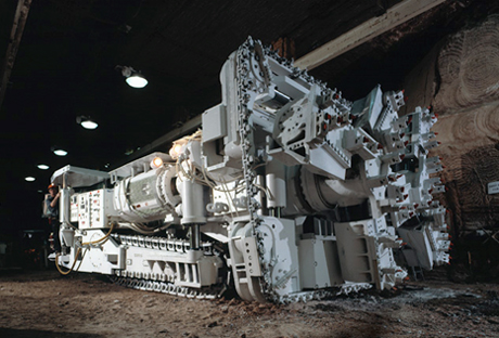
Figure 16-1: Borer Miner
The mining method employed at Agrium VPO is a room and pillar method utilizing long rooms and sequence delays to allow for stress relief. Mine excavations generally fall into two classes:
Entry systems are used to house conveyor belts, serve as travelways, provide ventilation routing for fresh and exhaust air and are designed to remain open for many years, provided that scaling and other maintenance programs are performed.
�
AGRIUM
VANSCOY POTASH OPERATIONS
67
Production panels are cut to extract ore from the mine as quickly and efficiently as possible. Panels historically consist of five long parallel rooms with regular spacing between rooms and between panels. The suitability of chevron mining as an alternative to the traditional panel mining is currently being investigated.
In order to maintain safe mine openings and provide a stable roof, it is imperative that the mining rooms always use a specific insoluble band designated the 413 seam by Phillips and locally known as the top B-4 seam as the top of the mining zone. Mining always takes place from this seam down 3.35m using the fixed height borers.
Borers usually cut approximately 0.15 m (6�)�above the mud seam to ensure all mud is removed and no loose rock develops. This dilution is incorporated into the composite grade used in grade estimations.
After 45 years of production, VPO has a Mineral Reserve remaining of 232.1�million tonnes (Proven Mineral Reserve of 175.7�million tonnes grading 25.6% K2O and Probable Mineral Reserve of 56.4�million tonnes grading 24.3% K2O). The Proven and Probable Reserve estimation is sufficient for approximately 29 years of mining life at the expanded rate of 2.8�million tonnes of product per year.
Measured Mineral Resources of 687.0�million tonnes grading 23.4% K2O and Indicated Mineral Resource of 214.9�million tonnes grading 25.4% K2O has the potential to add a further 32 years.
For more details the reader is referred to the previous Technical Report dated February�15, 2012.
�
AGRIUM
VANSCOY POTASH OPERATIONS
68
| 17 | Recovery Methods |
Significant changes to the processing facility will be introduced by the VAULT expansion. The annual production rate will be increased to 2,800,000 tonnes from the existing 1,800,000 tonnes of product. The circuit is designed to process a range of ore grades between 22.0% K2O to 25.5% K2O, with an average expected grade of 24.6% K2O. The nominal milling rate will be 1,084 tonnes per hour (operating 24 hours per day). VPO produces an agricultural grade muriate of potash with an average product grade of 60.6% K2O (the product grade must exceed 60.0% K2O to achieve the product specification). The design product split will be 75% premium (2,100,000 tonnes per annum) and 25% non-premium (700,000 tonnes per annum). The amenability of the VPO ore body to recover and concentrate potash has been well established by the long processing history of the plant. Given the remarkable continuity of the Prairie Evaporite Formation potash beds the relative ease of concentration is not expected to change. The process improvements introduced by the VAULT expansion are supported by bench and pilot scale test work. Furthermore, industry proven technology with a minimum of one year of successful use within the potash industry has been used in the design to improve the recovery to 87%.
The increased production and recovery will be accomplished by modifying the existing circuits by installing new crushing, attrition scrubbing, slimes separation, scavenger flotation, and brine handling circuits and installing additional flotation and compaction circuit capacity. There will also be enhancements to the existing ore storage, crystallization, and loadout circuits. Below is a synopsis of the new concentrator process.
Concentrator Processing Steps
Ore Storage
The ore will be hoisted from underground at a nominal rate of 1,800 tph (typically operating for 16 hours per day). To assist in the continuous operation of the mill, there will be total of 35,000 tonnes of ore storage capacity on surface. The existing 5,000 tonnes of live ore storage will be maintained (called live ore as it can be automatically dispensed to the mill) and an additional manual reclaim facility with a 30,000 tonne capacity will be built. Ore will be direct fed from the hoist or reclaimed from storage at a nominal mill feed rate of 1,084 tph.
Crushing and Attrition Scrubbing
The purpose of the crushing circuit is to prepare the ore for the downstream process by reducing the material size to 95% less than 9.5mm (-3/8�). This is the optimal size for the liberation of the salt and
�
AGRIUM
VANSCOY POTASH OPERATIONS
69
insoluble material in this ore body. Crushing and scrubbing will be accomplished in two stages. The primary crush will be completed using a single stage of two parallel roll crushers after which the ore will be combined with saturated process brine to produce a slurry of optimal density for primary attrition scrubbing (two parallel banks of six 972 ft3 scrubbing cells). The discharge from the primary scrubbers is screened with the undersized (-6 mesh) material reporting to the primary deslime cyclones. Their overflow goes to slimes separation and the underflow to secondary scrubbing. The primary desliming screen oversize (+6 mesh) goes directly to secondary crushing which is done using one stage of three parallel cagepakors. The secondary crushing discharge is returned to the primary scrubber feed for further insol liberation. The secondary scrubber (two parallel banks of six 444 ft3 scrubbing cells) discharge is sent to the secondary deslime screens with the undersize material (-20 mesh) reporting to the secondary deslime cyclones. The cyclone underflow goes to fines rougher flotation conditioning and the overflow goes back to the primary deslime screen feed. The secondary screen oversize (+20 mesh material) goes on to coarse rougher flotation.
Slimes Separation
Slimes separation is required to remove the fine potash particles in the primary cyclone overflow from the unwanted insoluble material. This flow is passed over trash screens to remove larger foreign material that can impede the downstream process. The slurry that passes through the trash screens is sent to the inclined plate hydro-classifier to complete the slimes separation process. This is a major upgrade from the current process that will improve recovery. The current process uses insoluble (or slimes) flotation to achieve this step and hydro-classification has been proven throughout the potash industry to be a much more efficient and cost effective method. The hydro-classifier separates the insoluble material by controlling the up flow velocity through the unit. By doing so, with the assistance of a dispersing agent, one is able to maximize the removal of insoluble material and minimize the loss of fine potash particles. The hydro-classifier underflow reports to scavenger flotation while the overflow goes to the slime thickener for brine recovery. The 115� diameter slimes thickener, with the use of a flocculant, settles the insoluble material which is then sent to tailings. The settling process leaves clean saturated process brine which overflows from the slimes thickener and is returned to brine storage for reuse in the process.
Tailings and Brine Recovery
Proper management of saturated process brine is an essential component for sustaining the desired recovery. This is accomplished through the efficient reuse of saturated process brine through the efficient operation of the slimes thickener and the use of tailings cyclones to recover process brine and recycle it back to the process. In addition, the use of cyclo-washes on these cyclones allows the displacement of process brine with reclaim brine which is returned to tailings.
�
AGRIUM
VANSCOY POTASH OPERATIONS
70
It should also be noted that two of the tailings cyclones are sized to provide an underflow of 150 tonnes per hour (and at the proper particle size requirements) to the NSC Salt treatment facility. This facility is located in the Tailings Management Area (�TMA�) and converts waste tailings to a saleable salt product. These cyclones operate intermittently.
The remainder of the tailings are deposited in the TMA where the solids suspended in the slurry settle onto the tailings pile. Brine leaches out of the pile and eventually makes it way to the reclaim brine pond through a series of interconnected collection ditches. Reclaim brine from the pond is returned to the mill to provide cooling in the crystallization circuit as well as brine make up where required. Excess reclaim brine is injected into a deep well aquifer.
Fines and Coarse Rougher Flotation
Fines and Coarse Rougher Flotation are the first stages of potash recovery. The split between the two circuits occurs at the secondary deslime screens with the +20 mesh material reporting to coarse rougher flotation and the -20 mesh reporting to the fines rougher flotation. Prior to entering the flotation circuits the feed slurry needs to be conditioned. A depressant is first added to coat residual insoluble material as these particles impede the performance of the flotation reagents. The flotation reagents used in the conditioning process, in order of addition, are potash collector, flotation oil promoter and frother, which assist the production of stable flotation bubbles. The method is effective in producing potash particles in the coarse flotation concentrate as large as 3.4 mm (6 mesh).
Cleaner and Re-cleaner Flotation
The fines flotation concentrate (along with the coarse rougher concentrate screen undersize) then goes through cleaner flotation. The concentrate from these conventional flotation cells goes onto re-cleaner flotation. This is done to ensure the product achieves the desired grade. In the existing (East) plant the cleaner tails will join the fine rougher tails and feed to the coarse roughers. In the expanded (West) plant the cleaner tails report to the regrind rougher cyclones. The re-cleaning step is done with conventional cells in the East plant and with pneumatic column flotation in the West plant. Recent developments within the industry have revealed improved recovery and selectivity by using this method, in both the East and West plants the re-cleaner flotation concentrate makes its way to respective the product centrifuges and the tails is recycled back to cleaner flotation feed.
�
AGRIUM
VANSCOY POTASH OPERATIONS
71
Scavenger Flotation
Scavenger flotation is used to recover the fine potash particles from the hydro-classifier underflow, the cleaner flotation tails (existing plant), and the product centrifuge effluent cyclone overflow (both new and existing circuits). Once again, due to their superior recovery and selectivity, pneumatic column cells (three parallel 15� x 30� cells) will be used in this application. The concentrate from these cells is debrined and goes on to crystallization and tails report to the fine salt thickener, where the brine is recovered and the solids are sent onto tailings.
Regrind Circuit
The coarse rougher flotation circuit is required to maximize the production of coarse material and minimize the generation of finer material. However, in the tailings of the coarse rougher flotation circuit there is a significant amount of potash that isn�t sufficiently liberated. The regrind circuit is designed to recover this material by screening, crushing and re-floating the desirable potash from the coarse rougher tails. The flotation cells in this circuit use stepped banks to allow reagent conditioning at critical locations of the regrind process. The regrind circuit is a closed circuit as the regrind flotation tails are screened and recycling back to the feed. Only the regrind flotation concentrate and regrind eventually exit the circuit to re-cleaner flotation and the tails screen undersize go to the tails cyclones.
Crystallization
The crystallization circuit is required to maximize overall recovery. This circuit converts low grade fine material to high grade product of sufficient size though the use of differential crystallization. The existing crystallization will continue to be used, taking its feed from the concentrate of the scavenger column flotation cells and the fine dust from the product loading operations. The product from this circuit is sent to the product centrifuges. There will be some modifications to the circuit, with the primary goal of improving heat recovery and thus making the process more efficient.
Product Centrifuges
These centrifuges de-brine the flotation and crystallization product prior to entering the production dryers. The centrifuges in the existing circuit will continue to be used and two additional centrifuges will be installed in the new circuit.
�
AGRIUM
VANSCOY POTASH OPERATIONS
72
Product Drying
The product is dried using fluidized bed dryers. The two existing product dryers will stay in service and an additional one is being installed in the new circuit. The dryer discharge consists of the desired dry product but also the exhaust airflow, which is entrained with fine KCl particles. In order to maximize recovery these fine particles are captured using gas cyclones, with the underflow reporting to the dryer product discharge and the overflow (exhaust) being further treated with a wet scrubber to reduce emissions below the regulatory requirements.
Sizing
After drying, the product is sent to sizing where it is sized to produce non-premium product. Anything that does not meet this specification is sent to compaction to produce premium product. The existing sizing circuit will not be upgraded but the entire product from the new circuit will skip sizing operations and go directly to compaction plants #4 and #5.
Compaction
Compaction is required to produce premium product. The sizing of the much desired premium product is larger than the size of straight run natural crystals produced in flotation. The feed to the compaction circuit ranges from fine high grade KCl dust to coarse product and these circuits efficiently upgrade this material to the desired premium product size specifications. The existing three compaction plants will stay in service and two additional plants will be built. These plants consist of their own independent circuits which contain compactors, multi-deck sizing screens for each stage, crushers, and Cagepacktor. In addition, to produce a relatively dust free product, glazing circuits, which include a rotary conditioner and glazing dryers, are part of every compaction plant. Glazing dryer exhaust gasses are treated with cyclones (for dust recovery) and wet scrubbers to reduce emissions to below the required levels.
Product Storage
All premium and non-premium product produced is dispatched from the mill to the existing product storage building. The only modifications to be made in this building will be increasing the speed of the reclaim belts to accommodate the higher loading rates.
�
AGRIUM
VANSCOY POTASH OPERATIONS
73
Loadout
The resizing circuit which resizes product that is reclaimed from product storage prior to it being loaded into trucks or rail cars, will be modified. The existing air classification system will be replaced with high capacity screens. These screens are more efficient and require less power to operate. In addition, a separate truck loading facility will be built to improve overall loading efficiency. The designed loading rate is 275,000 tonnes per month.
Utilities
Electrical power consumption is expected to increase by 200%. This is required to operate the new and existing plants and facilitate underground expansion. Electrical efficiency techniques will be employed wherever possible. The new process will require no additional water usage and therefore consume no more than 945 gallons/minute. Several water conservation initiatives are being deployed to ensure this goal. Also, the only additional reagent that will be required will be a dispersing agent for the new hydro-classifier. Again, this has been used in other conventional potash mining process and meets all regulatory requirements. All other reagents will remain the same, with their consumption rate improving and at worst remaining the same.
�
AGRIUM
VANSCOY POTASH OPERATIONS
74
| 18 | Project Infrastructure |
The infrastructure at the mine site includes the following key items:
�
| � | � | � | Mine site location access infrastructure |
�
| � | � | � | Site power supply |
�
| � | � | � | Tails management area (�TMA�) |
�
| � | � | � | Rail access |
�
| � | � | � | Nearby towns and villages |
The VPO potash operations are approximately 30 km south west of the city of Saskatoon near the village of Vanscoy. Access is north west off highway 7 via approximately 6.5 km of all weather, paved road.
Electrical energy is provided from the SaskPower distribution grid via a 138 kv power line sized to accommodate expansion needs.
An integral part of the surface infrastructure required by a potash mine is the tailings management area (TMA) and associated brine disposal system. The licensed TMA encompasses approximately 615 hectares (ha) of land, with approximately 480 ha currently being used for tailings storage. The TMA inputs include salt, insoluble silt and clay (fine tailings) and brine. The salt tailings are deposited near the central region of the TMA forming a pile as the salt height increases. A fraction of the salt is diverted to NSC Minerals Inc. for processing and subsequently transported off site for industrial and agricultural uses. Free brine is decanted off of the salt tailings pile to the brine pond situated on the north portion of the existing TMA. Brine is continuously circulated from the mill to the brine pond for operation. Two licensed injection wells currently dispose of excess brine into deep subsurface aquifers and maintain operating levels within the brine pond.
Process water is provided by a dedicated water line from the South Saskatchewan river. This line also services the village of Vanscoy and several farmsteads along the route.
The VPO site is serviced by a railway spur line connecting to both Canadian Pacific and Canadian National Railways trans Canada rail lines.
�
AGRIUM
VANSCOY POTASH OPERATIONS
75
VPO is near the village of Vanscoy and the town of Delisle. Having ready access to the city of Saskatoon, these communities offer a convenient alternative to living in Saskatoon for many Agrium employees.
�
AGRIUM
VANSCOY POTASH OPERATIONS
76
| 19 | Market Studies and Contracts |
The United Nations estimates that the global population growth will reach eight billion people in 2020. Producing enough food to feed the world�s rapidly growing population has been a challenge in recent years. Population growth along with growing affluence in emerging markets, such as China and India, are expected to continue to drive strong food demand growth. Another key potash demand driver is the expanded production of ethanol from agricultural crops such as corn and sugar cane. With finite supplies of arable land globally, the productivity of existing arable land must be improved to grow enough food to meet increased demand. One means to improve productivity is through more balanced fertilization. The top four consuming regions, China, North America, Brazil and India, account for almost 60 percent of consumption. Deficient soils in the three major offshore markets of China, India, and Brazil will provide opportunity for long-term sustained growth in consumption.
�

Source: IFA, Fertecon,
Figure 19-1: Global Potash Supply
(Source: Fertecon, IFA)
Global demand for potassium is estimated at 38.3 Mt K2O in 2018, equating to an average annual growth rate of 3.0% between 2013 and 2018. World potash demand would expand at an average annual rate of 1.6 Mt MOP p.a. between 2013 and 2018. (from IFA website)
�
AGRIUM
VANSCOY POTASH OPERATIONS
77
Between 2012 and 2013, global potash delivered volumes grew at an average of 4.2%�per year. If global consumption continues to grow at the long term average trend rate of 3.0%�per year over the next ten years, global potash production will need to increase by approximately 11�million tonnes K2O per year by 2024 to match demand. Agrium�s proposed, one million tonne expansion of potash production at VPO is well-timed to help the potash industry keep up with expected demand growth.
�

Source: IFA, Fertecon, Agrium
Figure 19-2: Global Potash Production
(Source: Fertecon, IFA)
As shown in Figure 19-2, Canada, Russia, and Belarus are the largest potash producing countries. According to published information dated June 2013 from the United States Geological Survey, Canada possesses approximately 46% of the world�s potash reserves and 35% of world production capacity. We expect this statistic will underpin Canada�s continued position as the world�s leading potash producer well into the future.
�
AGRIUM
VANSCOY POTASH OPERATIONS
78
�

Source: Fertecon, IFA, Agrium
Figure 19-3: Global Potash Exports
(Source: Fertecon, IFA)
Figure 19-4 indicates global potash exports by country since 2007. International sales (outside the United States and Canada) of potash produced by Agrium are distributed through the export marketing consortium Canpotex, which is equally owned by PCS, Mosaic and Agrium. Canpotex has a long history of being a reliable supplier to international markets and of proven marketing capabilities that will grow as its ownership group expands its production capacities and volumes available for export outside the North American market. Other major potash exporting countries include Russia, Belarus and Germany. Agrium is a major wholesale distributor of crop nutrition product with demonstrated capabilities to transport and store large product volumes in the US and Canada and is well positioned to market increased potash sales volumes in North America. Agrium also is the largest retail supplier of crop input products and services to farmers in North America. As its retail business expands, Agrium expects its potash supply requirements will also increase.
�
AGRIUM
VANSCOY POTASH OPERATIONS
79
�

Figure 19-4: Historic Vancouver FOB Potash Prices
(Source: Fertecon)
Figure 19-5 shows a long history of potash prices that after the spike seen in the shortage years of 2008-2009 have stabilized at levels much higher than experienced prior. This can be attributed to stable potash demand growth and strong agricultural economic fundamentals. We expect future potash prices to remain above long term historic values.
VPO is an established production facility and as such has established contracts in numerous areas to support the operation. Long term transportation agreements with Canada�s two major railways (CN and CP) are in place and managed through a centralized marketing and distribution team within the Wholesale business unit. Truck transport is arranged by the customer, but coordination can be provided by Agrium resources. Significant sales agreements do exist and are continuously monitored and negotiated internally. Agrium�s existence throughout the value chain is a significant competitive advantage. Access to significant retail customers solidifies North American sales, which is especially
�
AGRIUM
VANSCOY POTASH OPERATIONS
80
important during periods of market disruption. Closer to the operation, supply contracts for critical operating supplies and reagents are continuously reviewed to maintain optimal supply and to optimize pricing.
�
AGRIUM
VANSCOY POTASH OPERATIONS
81
| 20 | Environmental Studies, Permitting and Social or Community Impact |
Environmental Studies
The by-products of potash extraction are insoluble fine tailings (clay) and salt tailings. The TMA is the final destination for these tailings. With an increase in potash production, there will be a corresponding increase in tailings deposition rates. The site has conducted a review of its TMA and developed a plan to extend the current tailings operations through 2077 in the currently approved footprint. As part of the VAULT project the following scope was completed: relocated and increased the size of its brine pond, relocated and increased the size of the FTMA, and developed plan for significantly higher salt pile heights.
A slope stability study is underway to fully understand the sensitivities of containment dyke geometries, deposition rates and duration, and brine mound effect on pore water pressures in the underlying soils. Additional slope inclinometers and pore water pressure transmitters will be installed in key areas of the pile to monitor pile stability. A project was completed to reduce the slope of a large section of the pile from a 2:1 run over rise ration to a 3:1 ratio.
Salt deposition is partly offset by excess brine injection into the Deadwood Formation and a road salt operation actively removing tailings from the pile.
Permitting
Agrium is in compliance with all environmental permitting requirements. The site is currently permitted by the Ministry of the Environment pursuant to The Environmental Management and Protection Act, 2002 and the Clean Air Act. The approval number is PO07-073. The approval was recently extended to expire on January�3, 2017 and Agrium has submitted a request to extend the current operating permit. The approval covers the topics of waste disposal, release and spill reporting, ceiling limits for particulate emissions, operating level limits on the brine pond, environmental monitoring and inspection requirements, above ground storage tanks, groundwater monitoring requirements, environmental contingency plans (emergency response), and a permit to operate waterworks.
The operating potash mines have agreed to provide the province of Saskatchewan with financial assurances in the form of an irrevocable trust. Each producer has agreed to contribute a total of $25 million to their respective trusts for the purpose of decommissioning, restoring and rehabilitating their mines site(s). The trust will remain in effect until all obligations relating to decommissioning, restoration and rehabilitation have been performed by Agrium. Agrium�s trust balance is $1,923,077 as of June�30, 2014. The remaining funding profile requires Agrium to contribute $1,923,077 every July�1st until July�1, 2026 (i.e. the next 12 years).
�
AGRIUM
VANSCOY POTASH OPERATIONS
82
The fundamental assumption in the decommissioning strategy is the natural dissolution of salt waste and injection of brine. After cessation of normal operations, decommissioning for the Agrium site is planned as follows:
�
| � | � | � | Decommissioning the site including underground and surface operations, but excluding the existing fresh water system, brine injection, and all associated equipment and services required to continue long-term dissolution of soluble solids using precipitation as the water source and injection of brine. |
�
| � | � | � | The natural dissolution of the salt pile will be a long process as the current plan is to use annual precipitation as the only source. Potash producers will continue to discuss with the Ministry of Environment alternatives to expedite the reclamation process. |
�
| � | � | � | Provide the necessary human resources and equipment to inspect, maintain and operate the facility, with the resulting collected brine being clarified and injected into the Deadwood Formation. |
�
| � | � | � | Maintain environmental monitoring of the entire TMA system. |
�
| � | � | � | Install systems, as required, to prevent release of contaminants outside of the approved TMA boundaries. |
�
| � | � | � | After removal of the salt tailings pile, monitoring will continue until acceptable final decommissioning levels have been achieved. |
�
| � | � | � | Finally, all disposal and monitoring systems will be decommissioned. |
Operational Risks
The site has experienced one slope failure on the east side of the existing tails pile. The cause of this failure was extensively modelled to learn about deposition parameters critical in preventing future failures. As a follow-up from this work, the west and north-west slopes of the tails pile have been identified as having low safety factors. The site remediated these slopes in 2013.
�
AGRIUM
VANSCOY POTASH OPERATIONS
83
| 21 | Capital and Operating Costs |
Taxes
Royalties are paid to the Province of Saskatchewan, which holds most of the mineral rights in both the KL 114-R & KL 204 lease areas. Royalties from non-Crown lands are paid to various free-holders of mineral rights in the area. The royalty rate calculation is governed by the Subsurface Minerals Regulations, 1960 (Saskatchewan) and varies as a function of selling price, mineral grade, exchange rate, source of ore tonnes, plus other factors.
Municipal taxes are paid based on site property values to the Rural Municipality of Vanscoy. VPO also pays a �potash production tax� to the Province of Saskatchewan following a formula based on sales and profits from Saskatchewan operations. In addition to this, VPO pays corporate income taxes based on corporate profits from all operations.
Capital and Operating Cost Estimates
The VPO site has been in operation since 1969. In the years immediately preceding this, major capital investment was made to bring the mine into production. Since then, capital expenditures have been made on a regular and ongoing basis to sustain and expand production.
In 2011 it was announced that VPO would be expanded to increase operational capacity to a total of 2.8�million tonnes muriate of potash product per year. This major expansion has an estimated cost of U.S.$2.33 billion. Engineering commenced in 2010 and initial early work construction started in 2011. It is estimated that full production will be achieved in 2017. A summary of the forecasted expansion costs is outlined below in Table 21-1.
�
AGRIUM
VANSCOY POTASH OPERATIONS
84
Table 21-1: Forecasted VAULT Expansion Capital Costs
�
| Table�21.1 |
� | |||||||
| Shaft�Headframe�and�Above�Ground�Mining�Buildings |
�� | $ | USD�billions | �� | �� | $ | 0.19 | �� |
| Surface�Ore�Handing |
�� | � | � | �� | �� | � | 0.23 | �� |
| Ancilliary�Buildings (offices/shops etc.) |
�� | � | � | �� | �� | � | 0.02 | �� |
| Underground�Equipment�&�Development |
�� | � | � | �� | �� | � | 0.14 | �� |
| Process Plants |
�� | � | � | �� | �� | � | 1.05 | �� |
| Compaction |
�� | � | � | �� | �� | � | 0.40 | �� |
| Infrastructure |
�� | � | � | �� | �� | � | 0.23 | �� |
| Product�Loadout |
�� | � | � | �� | �� | � | 0.07 | �� |
| �� | �� | � |
� |
� | ||||
| Total |
�� | $ | USD�billions | �� | �� | � | 2.33 | �� |
| �� | �� | � |
� |
� | ||||
The $2.33 billion cost estimate excludes pre-project investigation costs and engineering studies completed prior to Board of Directors� approval of the expansion.
Operating costs for the facility are largely driven by labour requirements. As we expand production, more equipment and manpower resources are required in both the mine and mill facilities to cover production, maintenance and administrative requirements. Additionally, as the mine transitions into deeper sections of the ore body in the South Block, and eventually into KL 204, mine rehabilitation costs are expected to increase to deal with the impact of increased ground pressure. These costs are expected to manifest themselves in both equipment and manpower and have been included in forecast projections. These, and other adjustments such as reagent usage, have been reflected in operating cost estimates that are updated annually for a forward looking period of 20 years. These projections result in cost per tonne projections that are expected to peak during the period of intense ramp-up before decreasing and levelling off at a more normalized level once full production rates are attained.
�
AGRIUM
VANSCOY POTASH OPERATIONS
85
| 22 | Economic Analysis |
In developing the economic analysis, a discounted cash flow (�DCF�) model was employed to determine the net present value (�NPV�) and internal rate of return (�IRR�) of the one million metric tonne VAULT brownfield expansion. The discounted cash flow model yields a NPV for the expansion project of $126 million USD at a discount rate of 9% and an IRR of 9.51%. It is assumed that this project will be financed with internally generated cash flow and no allowance has been made for debt financing in this analysis. The economic analysis of the project was performed on an after-tax basis. Agrium pays federal and provincial income taxes based on profits from operations. Royalties are paid to the Province of Saskatchewan based on muriate tonnes produced, the raw ore grade and the weighted average net selling price of potash for the production month in question. In addition, Agrium pays a Potash Production Tax and a resource surcharge to the Government of Saskatchewan. The Potash Production Tax is calculated based on profit per K2O tonne at a rate of 15% up to $40 CAD per tonne indexed to 1989 GDP (approximately $65 CAD per tonne for 2013) and 35% on the remainder of the profits. As part of the Potash Production Tax, Agrium may be subject to a base payment. The base payment amount is $11.00 to $12.33 CAD per K2O tonne. Allowable deductions include royalties and 1% of gross revenue for the year. In 2013, the base payment amount was zero. Property taxes are paid according to property values and were $3.8 million CAD in 2013. Currently, Saskatchewan provincial sales tax is 5%.
A DCF model requires the use of forecasts for economic inputs and the impact of economic inputs on model results can vary significantly. A sensitivity analysis was performed to determine the impact of changes in the key assumptions on the resulting incremental NPV of the expansion. The sensitivity ranges chosen were: price of +/- $50 per tonne Brazil cfr, foreign exchange rate of +/- $.10 USD/CAD and production ramp-up (2016)�at +/- 200�thousand metric tonnes. Model assumptions, economic metrics and sensitivity analysis are shown in Table 22.1.
�
AGRIUM
VANSCOY POTASH OPERATIONS
86
Table 22-1: Sensitivity Analysis Results on VAULT Expansion Project
�
| Table�22.1 |
� | |||||||||||
| Year | � | Production KCl |
� | � | Investment�capital1 | � | � | FX | � | |||
| � | � | (million�tonnes) | � | � | (millions�$USD) | � | � | (USD-CAD) | � | |||
| 2012 |
� | � | 1.4 | �� | � | $ | 471 | �� | � | � | 1.00 | �� |
| 2013 |
� | � | 1.7 | �� | � | $ | 782 | �� | � | � | 1.03 | �� |
| 2014 |
� | � | 1.1 | �� | � | $ | 875 | �� | � | � | 1.10 | �� |
| 2015 |
� | � | 2.1 | �� | � | $ | 210 | �� | � | � | 1.12 | �� |
| 2016 |
� | � | 2.4 | �� | � | $ | 0 | �� | � | � | 1.11 | �� |
| 2017�and�thereafter |
� | � | 2.8 | �� | � | $ | 0 | �� | � | � | 1.11 | �� |
�
| 1� | Includes shaft & headframe, ore handling, buildings, underground equipment, process plants, compaction, infrastructure and loadout. |
�
| * | Mine life of 61 years at expansion production rates. |
�
| Expansion�Project�Economics | �� | � | � | |
| NPV 9% (millions $USD) |
�� | $ | 126 | �� |
| IRR |
�� | � | 9.51 | %� |
| Simple payback (from 2015) |
�� | � | 10.4�years | �� |
�
| * | Valuation date�of December 31, 2011. |
| * | Potash revenue from 2015 through 2025 is based on the potash price forecast published by the independent consulting agency, FERTECON Limited. |
| * | Potash revenue for 2026 and beyond is based on potash prices that are reflective of a breakeven replacement cost economics for a generic Saskatchewan potash project. |
| * | Annual cash flows derived from the expansion project result in a 9.51% IRR and meet or exceed internal investment thresholds. |
�
| Price�Sensitivity | � | � | � | � | � | � | � | � | � | |||
| � | � | -$50/tonne | � | � | base | � | � | +$50/tonne | � | |||
| NPV 9% (millions $USD) |
� | -$ | 309 | �� | � | $ | 0 | �� | � | $ | 302 | �� |
| Foreign Exchange Sensitivity | � | � | � | � | � | � | � | � | � | |||
| � | � | -$.10�USD-CAD | � | � | base | � | � | +$.10�USD-CAD | � | |||
| NPV�9%�(millions�$USD) |
� | -$ | 61 | �� | � | $ | 0 | �� | � | $ | 48 | �� |
| Production�Ramp�Up�Sensitivity | � | � | � | � | � | � | � | � | � | |||
| � | � | -200kmt�in�2016 | � | � | base | � | � | +200kmt�in�2016 | � | |||
| NPV�9%�(millions�$USD) |
� | -$ | 26 | �� | � | $ | 0 | �� | � | $ | 26 | �� |
�
AGRIUM
VANSCOY POTASH OPERATIONS
87
| 23 | Adjacent Properties |
Mining the same potash beds as VPO, the PCS Cory Division mine is located northeast of VPO�s KL 114-R lease. According to the PCS Cory Division NI 43-101 technical report filed in February 2010 (the �PCS Technical Report�), the mine has been in existence since 1968 and has produced over 26�million tonnes of product from over 80�million tonnes of ore mined, grading 23.2% K2O equivalent at an average mine extraction rate of 27% to December�31, 2009.
The information provided in the NI 43-101 technical report has been disclosed by PCS as having been prepared under the supervision of a �qualified person� under NI 43-101. We have not been able to verify the information contained in the PCS Technical Report and the information contained therein is not necessarily indicative of the mineralization on the property.
�
AGRIUM
VANSCOY POTASH OPERATIONS
88
| 24 | Other Relevant Data and Information |
It is the author�s opinions that there is no other relevant information.
�
AGRIUM
VANSCOY POTASH OPERATIONS
89
| 25 | Interpretation and Conclusions |
The Vault expansion assumes 2.82 tonnes of ore will be required to produce 1 tonne of product. Commonly called a concentration factor, this is an amalgamation of ore grade, milling extraction and product quality.
It is reasonable to expect a significant portion of the Inferred Mineral Resources will be upgraded to Indicated Mineral Resources and Measured Mineral Resources as exploration programs are undertaken in the North Expansion Block and the South Block. This has the potential to significantly increase mine life.
In Saskatchewan mining history, with the exception of PCS Allan Division, all potash mines have experienced brine inflows. In 1985, a brine inflow occurred on the western edge of the VPO mine in the order of 125 USGPM. This appears to be the maximum productive capability of the Dawson Bay Formation in the Saskatoon region. It is considered a nuisance brine inflow, unlike the high volume, mine threatening inflows that have occurred at PCS Rocanville, Mosaic Esterhazy and PCS Patience Lake. Brine chemistry and flow rate have remained essentially unchanged since 1985. Although an additional cost to the operation due to the continued maintenance of access entries to monitor and manage, it is considered of minimal risk to the remaining reserve and resource estimates. In 1989, Kendall (SMER Report) suggested the presence or absence of the Harris or Davidson halites of the Souris River Formation determined whether or not the Dawson Bay Formation was salt plugged or contained large quantities of brine. Where the Davidson halite was missing he suggested the Dawson Bay would have a much higher potential to produce water. Hence, seismic programs always identify areas where the Davidson halite is thought to be missing and flag them as �no mining� or �high risk� areas. A number of the 2010 and 2011 drilling program holes did produce significant amounts of water from the Dawson Bay from areas where the Davidson halite was missing. As there seems to be a correlation between wet Dawson Bay and missing Souris River halites, these seismically identified regions, when accompanied by wet drill holes, have been removed from the resources as a measure to mitigate the risk of future mine inflows of water. Agrium continually attempts to improve the information potential of the seismic programs by investigating new interpretation techniques in order to reduce the water inflow risk.
The depth to the mining horizon progressively increases to the southwest. As development opens the South Block, the increased depths will result in a corresponding increase in the overburden load. The reader is cautioned that there is a risk that this will result in a reduced useable life for main entry systems accessing the far south, and an increase mining and rehabilitation costs. Agrium maintains a geotechnical program monitoring mine deformations, and actively investigates alternative mining sequences to ensure safe mining conditions.
�
AGRIUM
VANSCOY POTASH OPERATIONS
90
Processing and Production Risk
Tie in of the VAULT expansion will occur during VPO�s 2014 turnaround with commissioning and production ramp up to follow. Process development, commissioning, and production ramp up risks which could impact milling throughput, product grade, and separation efficiency are minimized by founding the design on proven and accepted experience, potash processing methods, and equipment selections. Where applicable in the overall process, recently improved potash processing technologies such as double roll crushers, column flotation, and hydroclassifier are used. Preliminary test work was conducted to determine the suitability and sizing of the equipment for attrition scrubbing, hydroclassifier, and slimes thickener. Efforts have also been made in standardizing equipment selections and sizes with the existing operation. The design criteria developed for the project is based on experience and data from the current VPO facility. Applicable test work, trade-off studies, and design criteria are fully detailed in the VAULT Design Basis Memorandum (DBM).
�
AGRIUM
VANSCOY POTASH OPERATIONS
91
| 26 | Recommendations |
Seismic data acquisition is essentially complete in the south block. Additional drill holes as required over the life of the mine will upgrade the Inferred Mineral Resources to Measured Mineral Resources.
A similar seismic acquisition and drilling program is recommended in the North Expansion Block.
A review of internal QA/QC practices is recommended and that channel sampling be continued.
It is also recommended that methods for collecting grinder samples be investigated to improve the accuracy.
In order to ensure long-term access to the south, mine plans should incorporate an unmined corridor of a width that will allow alternative entries to be cut should significant problems arise as systems age.
The Lower Patience Lake Member has a thick salt beam in the immediate back and may offer a stable alternative horizon for main entries to the deeper regions of the South Block. It is recommended that the concept be investigated.
The mine maintains a rigorous reporting system that reconciles mine production tonnes and grade with mill production. It is recommended that this reconciliation process be continued.
�
AGRIUM
VANSCOY POTASH OPERATIONS
92
| 27 | References |
Agrium production records, financial records, environmental permitting and process documentation and Agrium website.
CIM Standards on Mineral Resources and Reserves: Definitions and Guidelines. December, 2005.
CIM Estimation of Mineral Resources and Mineral Reserves Best Practice Guidelines (November 23, 2003).
Drill hole records for all holes associated with the KL 114-R lease � Agrium contained.
Estimation of Mineral Resources and Mineral Reserves � Best Practices Guidelines, CIM, November 2003.
Exploration Best Practices Guidelines, CIM, August 2000.
Garrett, D. E. Sequential Flow During Evaporation. Potash Deposits, Processing, Properties and Uses, 1996.
Holter, M. E. Department of Natural Resources Report No 123 � The Middle Devonian Prairie Evaporite of Saskatchewan, 1969.
Kilborn Engineering Ltd. Engineering study, 1965.
National Instrument 43-101: Standards of Disclosure for Mineral Projects. June�30, 2011.
National Instrument 43-101 Technical Report on Cory Potash Deposit (KL 103-R), Saskatchewan, Canada, February�26, 2010 - SEDAR.
Stearns-Roger Canada Ltd. Engineering study, 1965.
Phillips. D Godon, Nomenclature For Use in Saskatchewan Potash, October�9, 1982.
National Instrument 43-101 Technical Report on Vanscoy Potash Operations, February�15, 2012.
�
AGRIUM
VANSCOY POTASH OPERATIONS
93
Technical Report Potash Mineral Reserves and Resources, Agrium Vanscoy Potash Operations, November 2009.
�
AGRIUM
VANSCOY POTASH OPERATIONS
94
EXHIBIT 99.2
November�13, 2014
Agrium Inc.
13131 Lake Fraser Drive S.E.
Calgary, AB T2J 7E8
Ladies and Gentlemen:
Reference is made to Agrium Inc.�s shelf prospectus supplement, dated November�13, 2014, to a short form base shelf prospectus dated April�24, 2014 including the documents incorporated by reference therein (the �Prospectus�), and the registration statement on Form F-10 dated April�24, 2014 and any amendments thereto, including post-effective amendments (collectively, the �Registration Statement�)
I, A. Dave Mackintosh, B.Sc., P. Geo., a qualified person, am responsible for preparing or supervising the preparation of certain sections of the technical report entitled �National Instrument 43-101 Technical Report on Vanscoy Potash Operations, Vanscoy, Saskatchewan, Canada� dated effective October�31, 2014 (the �Technical Report�).
I hereby consent to the inclusion and incorporation by reference in the Prospectus and the Registration Statement, including any amendments thereto and any documents incorporated by reference therein, of references to and information derived from the Technical Report, and to the use of my name in the Prospectus and the Registration Statement.
Yours truly,
/s/ A. Dave Mackintosh, B.Sc., P.Geo
A. Dave Mackintosh, B.Sc., P.Geo
EXHIBIT 99.3
November�13, 2014
Agrium Inc.
13131 Lake Fraser Drive S.E.
Calgary, AB T2J 7E8
Ladies and Gentlemen:
Reference is made to Agrium Inc.�s shelf prospectus supplement, dated November�13, 2014, to a short form base shelf prospectus dated April�24, 2014 including the documents incorporated by reference therein (the �Prospectus�), and the registration statement on Form F-10 dated April�24, 2014 and any amendments thereto, including post-effective amendments (collectively, the �Registration Statement�).
I, William Aldo Grimm, P.Eng., a qualified person, am responsible for preparing or supervising the preparation of certain sections of the technical report entitled �National Instrument 43-101 Technical Report on Vanscoy Potash Operations, Vanscoy, Saskatchewan, Canada� dated effective October�31, 2014 (the �Technical Report�).
I hereby consent to the inclusion and incorporation by reference in the Prospectus and the Registration Statement, including any amendments thereto and any documents incorporated by reference therein, of references to and information derived from the Technical Report, and to the use of my name in the Prospectus and the Registration Statement.
Yours truly,
/s/ William Aldo Grimm, P.Eng.
William Aldo Grimm, P.Eng.
EXHIBIT 99.4
November�13, 2014
Agrium Inc.
13131 Lake Fraser Drive S.E.
Calgary, AB T2J 7E8
Ladies and Gentlemen:
Reference is made to Agrium Inc.�s shelf prospectus supplement, dated November�13, 2014, to a short form base shelf prospectus dated April�24, 2014 including the documents incorporated by reference therein (the �Prospectus�), and the registration statement on Form F-10 dated April�24, 2014 and any amendments thereto, including post-effective amendments (collectively, the �Registration Statement�).
I, Michael Ryan Bartsch, P.Eng., a qualified person, am responsible for preparing or supervising the preparation of certain sections of the technical report entitled �National Instrument 43-101 Technical Report on Vanscoy Potash Operations, Vanscoy, Saskatchewan, Canada� dated effective October�31, 2014 (the �Technical Report�).
I hereby consent to the inclusion and incorporation by reference in the Prospectus and the Registration Statement, including any amendments thereto and any documents incorporated by reference therein, of references to and information derived from the Technical Report, and to the use of my name in the Prospectus and the Registration Statement.
Yours truly,
/s/ Michael Ryan Bartsch, P. Eng.
Michael Ryan Bartsch, P.Eng.
Serious News for Serious Traders! Try StreetInsider.com Premium Free!
You May Also Be Interested In
- LONGi Awarded "2026 Climate Lighthouse" Outstanding Case of 2026 Shanghai Climate Week: Zero-Carbon Technology Leads Green Transition
- Oilstainlab and Delphi Launch the Half-11 “Euro-Vision” Summer Tour
- UniXell Biotechnology Secures FDA IND Clearance for UX-DA003, Achieving China-U.S. Dual Breakthrough in iPSC Parkinson's Therapy
Create E-mail Alert Related Categories
SEC FilingsSign up for StreetInsider Free!
Receive full access to all new and archived articles, unlimited portfolio tracking, e-mail alerts, custom newswires and RSS feeds - and more!