



Vexcel Announces 3D Models for Metro Areas Around the World
 Tweet
Tweet Share
Share E-mail
- Explore and build with ready-made, high-quality 3D data models for major cities across the globe
- New large-scale 3D models span entire metro areas, not just city centers
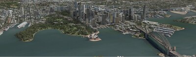
Vexcel is launching more than 60 3D Cities on four continents, including
"More than ever before, 3D models have become essential across multiple industries when it comes to design, planning, and analysis," said
For example, the 3D model of
The models consist of a 3D textured mesh packaged in the 3D Tiles OGC Community Standard created by Cesium, a flexible, open-source format that allows customers to adapt, integrate, and interact with their 3D data across many platforms to meet the needs of any workflow. It also lends itself to customized 3D visualizations and is directly compatible with popular tools and platforms commonly used for 3D integrations. Vexcel's 3D data is optimized for high performance and is off-the-shelf ready with no production turnaround time needed.
Examples of how multiple industries could benefit from this information include:
- Architecture, Engineering, Construction – planners can enhance their visualization, perform viewshed analysis
- Telecom – network designers can map clean lines-of-sight to simulate the propagation of radio signals and identify the best locations for antennas and base stations.
- Entertainment – video game designers can create and enhance animation design, support virtual tourism and immersive virtual and augmented reality applications
- Government – city engineers can use these digital twins for smart city planning and visualize the impact of natural hazards on city infrastructure and urban development
- Utilities – planners can use for asset management, demand forecasting, and the distribution of electricity, water, gas, and other utilities
- High-definition maps/fleet management – map engineers can verify building locations to map expanding neighborhoods, support more accurate autonomous vehicle mapping
Vexcel plans to add more 3D cities and metro areas based on customer demand. To learn more about this product and see the full list of available cities, visit vexceldata.com/3d-cities.
About Vexcel Data Program
For over 30 years, Vexcel has been the industry leader in the photogrammetric and remote sensing space, building market-leading UltraCam sensors, and providing a comprehensive library of cloud-based geospatial data. The Vexcel Data Program is the largest aerial imagery program in the world, collecting high-resolution imagery and geospatial data in 30+ countries. Its dedicated fleet of fixed-wing aircraft captures imagery in the
 View original content to download multimedia:https://www.prnewswire.com/news-releases/vexcel-announces-3d-models-for-metro-areas-around-the-world-302029077.html
SOURCE Vexcel Data Program
Serious News for Serious Traders! Try StreetInsider.com Premium Free!
You May Also Be Interested In
- QuintessenceLabs Introduces TSF® Sentry Cryptographic Assessment and PQC Readiness Assessment at Quantum World Congress
- Espey Mfg. & Electronics Corp. reports fourth quarter and year-end results
- Dryden Gold Intersects 7.88 g/t Gold over 12.70 Meters at Gold Rock
Create E-mail Alert Related Categories
PRNewswire, Press ReleasesSign up for StreetInsider Free!
Receive full access to all new and archived articles, unlimited portfolio tracking, e-mail alerts, custom newswires and RSS feeds - and more!
