

New Georgia Map Tool Offers Local Climate Change Insights
 Tweet
Tweet Share
ShareATLANTA, GA / ACCESS Newswire / April 20, 2026 / By: Emily Jones, WABE
Local leaders across Georgia can now see a more detailed picture of what impacts to expect from climate change with a new map tool released by Drawdown Georgia.
The group, which aims to reduce the state's greenhouse gas emissions, unveiled the maps at the Super South Summit in Atlanta last week.
Scientists warn that Georgia can expect hotter, longer summers, more extreme weather, more rainfall overall and also longer droughts. But those impacts will vary across the state.
Now, researchers have found ways to scale down big-picture data so they can project not just how climate change is affecting Georgia or the Southeast broadly, but also how it's changing conditions in specific locations.
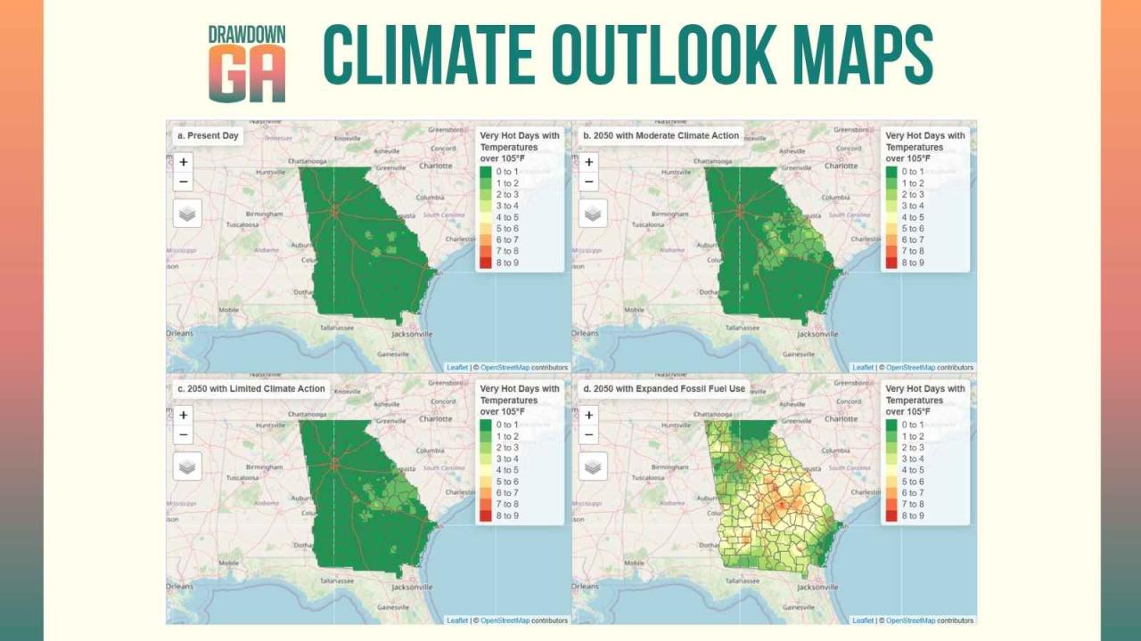
Image of Georgbia Climate Outlook Maps
Find more stories and multimedia from Ray C. Anderson Foundation at 3blmedia.com.
Contact Info:
Spokesperson: Ray C. Anderson Foundation
Website: https://www.3blmedia.com/profiles/ray-c-anderson-foundation
Email: [email protected]
SOURCE: Ray C. Anderson Foundation
View the original press release on ACCESS Newswire
Serious News for Serious Traders! Try StreetInsider.com Premium Free!
You May Also Be Interested In
- Google Gemini Launch Delayed as Tech Falls Short of Goals - Bloomberg
- Fed’s Schmid warns against assuming inflation is temporary
- Visterra Landscape Group Honors Fallen Veterans in Annual NALP Renewal & Remembrance Day of Service, Monday, July 20, at Arlington National Cemetery
Create E-mail Alert Related Categories
ACCESS Newswire, Press ReleasesRelated Entities
Maynard Um, Mark Zuckerberg, ARKSign up for StreetInsider Free!
Receive full access to all new and archived articles, unlimited portfolio tracking, e-mail alerts, custom newswires and RSS feeds - and more!